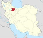
Ziaabad District
Appearance
Ziaabad District
Persian: بخش ضیاءآباد | |
|---|---|
| Coordinates: 35°58′11″N 49°21′16″E / 35.96972°N 49.35444°E[1] | |
| Country | Iran |
| Province | Qazvin |
| County | Takestan |
| Capital | Ziaabad |
| Population (2016)[2] | |
• Total | 18,918 |
| Time zone | UTC+3:30 (IRST) |
Ziaabad District (Persian: بخش ضیاءآباد) is in Takestan County, Qazvin province, Iran. Its capital is the city of Ziaabad.[3]
Demographics
[edit]Population
[edit]At the time of the 2006 National Census, the district's population was 21,149 in 5,814 households.[4] The following census in 2011 counted 19,532 people in 6,055 households.[5] The 2016 census measured the population of the district as 18,918 inhabitants in 6,224 households.[2]
Administrative divisions
[edit]| Administrative Divisions | 2006[4] | 2011[5] | 2016[2] |
|---|---|---|---|
| Dodangeh-ye Olya RD | 6,002 | 4,898 | 5,061 |
| Dodangeh-ye Sofla RD | 6,762 | 5,997 | 5,595 |
| Ziaabad (city) | 8,385 | 8,637 | 8,262 |
| Total | 21,149 | 19,532 | 18,918 |
| RD = Rural District | |||
See also
[edit]References
[edit]- ^ OpenStreetMap contributors (17 September 2024). "Ziaabad District (Takestan County)" (Map). OpenStreetMap (in Persian). Retrieved 17 September 2024.
- ^ a b c Census of the Islamic Republic of Iran, 1395 (2016): Qazvin Province. amar.org.ir (Report) (in Persian). The Statistical Center of Iran. Archived from the original (Excel) on 30 November 2021. Retrieved 19 December 2022.
- ^ Habibi, Hassan (c. 2023) [Approved 7 July 1369]. Approval of the organization and chain of citizenship of elements and units of the national divisions of Zanjan province, centered in Zanjan city. lamtakam.com (Report) (in Persian). Ministry of the Interior, Defense Political Commission of the Government Council. Notification 82844/T141K. Archived from the original on 16 December 2023. Retrieved 16 December 2023 – via Lam ta Kam.
- ^ a b Census of the Islamic Republic of Iran, 1385 (2006): Qazvin Province. amar.org.ir (Report) (in Persian). The Statistical Center of Iran. Archived from the original (Excel) on 20 September 2011. Retrieved 25 September 2022.
- ^ a b Census of the Islamic Republic of Iran, 1390 (2011): Qazvin Province. irandataportal.syr.edu (Report) (in Persian). The Statistical Center of Iran. Archived from the original (Excel) on 19 January 2023. Retrieved 19 December 2022 – via Iran Data Portal, Syracuse University.


