Wikipedia:Main Page history/2019 February 24
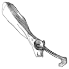
From today's featured articlePlesiorycteropus was a mammal from Madagascar that became extinct sometime after 200 BCE, as evidenced by radiocarbon dating. Upon its description in 1895 by French naturalist Henri Filhol, Plesiorycteropus was classified with the aardvark, but more recent studies have found little evidence for that linkage. Molecular evidence instead suggests that it is related to the tenrecs, in the order Afrosoricida. Two species are recognized, the larger P. madagascariensis and the smaller P. germainepetterae; subfossil remains of both species have been found in the same site. Only limb and partial pelvis and skull bones have been recovered to date. Plesiorycteropus was probably a digging animal that fed on insects such as termites and ants. It also shows adaptations for climbing and sitting. Estimates of its mass range from 6 to 18 kilograms (13 to 40 lb). Forest destruction by humans may have contributed to its extinction. (Full article...)
Recently featured:
Did you know...
|
In the news DNA double helix
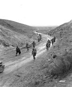
On this dayFebruary 24: Independence Day in Estonia (1918)
Marc-Antoine Charpentier (d. 1704) · Lydia Becker (b. 1827) · Judah Folkman (b. 1933)
More anniversaries:
|
Today's featured picture

|
|
Lancashire is a county in the north west of England. Founded in 1182, Lancashire emerged as a major commercial and industrial region during the Industrial Revolution. Liverpool and Manchester grew into its largest cities, with economies built around the docks and the cotton mills respectively. The county's borders were redrawn significantly in 1974, as the urban regions around Liverpool and Manchester were removed to form the counties of Merseyside and Greater Manchester and the northern area became part of Cumbria. This picture, titled The Countie Pallatine of Lancaster Described and Divided into Hundreds, 1610, is a map of Lancashire engraved in around 1627 by John Speed. It features a street plan of the county town, Lancaster, and side panels containing portraits of kings from the House of Lancaster and the House of York. Engraving: John Speed; restoration: Adam Cuerden
Recently featured:
|
Other areas of Wikipedia
- Community portal – Bulletin board, projects, resources and activities covering a wide range of Wikipedia areas.
- Help desk – Ask questions about using Wikipedia.
- Local embassy – For Wikipedia-related communication in languages other than English.
- Reference desk – Serving as virtual librarians, Wikipedia volunteers tackle your questions on a wide range of subjects.
- Site news – Announcements, updates, articles and press releases on Wikipedia and the Wikimedia Foundation.
- Village pump – For discussions about Wikipedia itself, including areas for technical issues and policies.
Wikipedia's sister projects
Wikipedia is hosted by the Wikimedia Foundation, a non-profit organization that also hosts a range of other projects:
Free media repository
Wiki software development
Wikimedia project coordination
Free textbooks and manuals
Free knowledge base
Free-content news
Collection of quotations
Free-content library
Directory of species
Free learning materials and activities
Free travel guide
Dictionary and thesaurus


