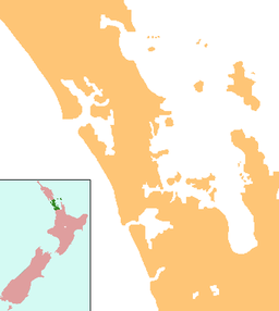
Tomarata Lake
| Tomarata Lake | |
|---|---|
 Jetskiing at Tomarata Lake in 2022 | |
| Location | Auckland Region, North Island, New Zealand |
| Coordinates | 36°11′38″S 174°39′04″E / 36.194°S 174.651°E |
| Primary outflows | Spectacle Lake |
| Basin countries | New Zealand |
| Max. length | 600 metres (2,000 ft) |
| Max. width | 320 metres (1,050 ft) |
| Surface area | 14.4 ha (36 acres)[1] |
| Max. depth | 6 metres (20 ft) |
| Surface elevation | 23 m (75 ft) |
Tomarata Lake is a lake at Tomarata, Rodney in the northern Auckland Region of New Zealand.[2]
Geography
[edit]Tomarata Lake is a sand dune lake located around 15 km (9.3 mi) northeast of Wellsford. It is adjacent to the Mangawhai Forest and near Te Ārai Regional Park.[3] The lake drains into Spectacle Lake, which in turn drains into Slipper Lake, and eventually flows into the Jellicoe Channel.[3] A former sand quarry is located near the lake, which over time developed into a lake itself.[4]
The lake was created when the Te Ārai sand dunes began to build up, preventing water from escaping the area.[5] It is the only example of a peatland lake in the Auckland Region.[6] The lake has no inflow streams, and is instead fed by rainwater and the surrounding wetlands.[5]
Biodiversity
[edit]The lake is a part of the Tomarata — Te Ārai Dune Lakes biodiversity focus area,[5] and is surrounded by extensive wetlands.[6]
The lake is home to many threatened bird species, such as the New Zealand fernbird, Eurasian bittern and the Buff-banded rail.[7][8]
Recreation
[edit]The lake is used for recreational swimming, boating and jetskiing, and is the most accessible of the northern Rodney lakes.[7][9]
See also
[edit]References
[edit]- ^ de Winton, M.D.; S. R. Elcock; A. T. Taumoepeau (June 2022), LakeSPI Assessment of 15 Auckland Lakes: 2021/2022 (PDF), National Institute of Water and Atmospheric Research, p. 2
- ^ "Place name detail: Tomarata Lake". New Zealand Gazetteer. New Zealand Geographic Board. Retrieved 18 June 2024.
- ^ a b "Tomarata Lake, Auckland". NZ Topo Map. Gavin Harriss. Retrieved 11 February 2024.
- ^ Preddey, Pulham (2017), Observations of New Zealand fairy tern (Sternula nereis davisae) foraging at Te Arai dune lakes, New Zealand, p. 88
- ^ a b c "Tomarata — Te Ārai Dune Lakes". Tiaki Tāmaki Makaurau Conservation Auckland. Retrieved 18 June 2024.
- ^ a b Hussain, Ebrahim (30 April 2021), "Citizen Science to The Rescue: Getting to the Bottom of Lake Tomarata", In Depth Magazine, retrieved 18 June 2024
- ^ a b Auckland Council, ed. (2013), Guide to Auckland's wetlands (PDF), retrieved 11 February 2024
- ^ Wells, Rohan (August 2016). The Impacts of Recreational Activities on Lake Tomarata's Ecology and Water Quality (PDF) (Report). Auckland Council. ISBN 978-1-927169-01-8. ISSN 2230-4533. Retrieved 18 June 2024.
- ^ "Tomarata". Visit Wellsford. Retrieved 18 June 2024.

