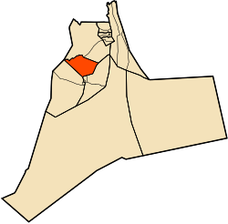
N'Goussa District
Appearance
N'Goussa District | |
|---|---|
 | |
| Coordinates: 32°8′22.6″N 5°18′46.5″E / 32.139611°N 5.312917°E | |
| Country | |
| Province | Ouargla Province |
| Chief town | N'Goussa |
| Time zone | UTC+1 (CET) |
The N'Goussa district is an Algerian administrative district in the Ouargla province. Its chief town is located on the eponymous commune of N'Goussa.[1][2]
Communes
[edit]The district is composed of only one commune: N'Goussa.
References
[edit]- ^ "N'Goussa District". OpenStreetMap. OpenStreetMap. Retrieved 12 May 2018.
- ^ "coordinates.txt". siris. Retrieved 12 May 2018.

