Sidi Khouïled District
Appearance
Sidi Khouïled District
دائرة سيدي خويلد | |
|---|---|
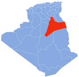
 Map of Algeria highlighting Ouargla Province | |
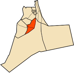
 Map of Ouargla Province highlighting Sidi Khouïled District | |
| Country | |
| Province | Ouargla |
| District seat | Sidi Khouïled |
| Area | |
• Total | 5,164 km2 (1,994 sq mi) |
| Population (2008) | |
• Total | 32,792 |
| • Density | 6.4/km2 (16/sq mi) |
| Time zone | UTC+01 (CET) |
| Communes | 3 |
Sidi Khouïled is a district in Ouargla Province, Algeria. It was named after its capital, Sidi Khouïled. As of the 2008 census, the district had a total population of 32,792.[1] Most of the population of this district lives just to the west of the provincial capital, Ouargla.
Communes
[edit]The district is further divided into 3 communes:[2]
References
[edit]- ^ "Population: Ouargla Wilaya" (PDF) (in French). Office National des Statistiques Algérie. Retrieved 24 February 2013.
- ^ "Official website of the province of Ouargla - state" (in Arabic). Retrieved 8 March 2013.
31°58′47″N 5°25′06″E / 31.97972°N 5.41833°E

