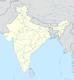
Lohachara Island
| Geography | |
|---|---|
| Location | Bay of Bengal |
| Archipelago | Sundarbans |
| Administration | |
India | |
| State | West Bengal |
| District | South 24 Parganas |
| Demographics | |
| Population | none |

Lohachara Island was an islet which was permanently flooded in the 1980s.[1] It was located in the Hooghly River as part of the Sundarban delta in the Sundarban National Park, located near the Indian state of West Bengal. The definite disappearance of the island was reported by Indian researchers in December 2006,[2] which led to international press coverage. No specific study was ever done to prove that the island was permanently inundated (and not eroded away) because of sea level rise.[3]
In April 2009 local newspapers announced that Lochara Island had risen from the water again.[4]
Overview
[edit]The islet is one of a number of "vanishing islands" in India's part of the delta: in the past two decades, four islands – Bedford (or Suparibhanga), Lohachara, South Talpatti Island (disputed island between Bangladesh and India), and Kabasgadi – have been permanently flooded. Of them, only Lohachara was an inhabited island where more than 6,000 people used to live. The loss of land has displaced thousands of people who were forced to move to the mainland.[5]
There are multiple causes[6] of the disappearances of islands in the delta, including sea level rise, coastal erosion, cyclones (while the number of cyclones has decreased, their intensity has increased),[7] mangrove destruction and coastal flooding.
In 1974 the Farakka Barrage began diverting water into the Hoogly River during its dry season. During each monsoon season almost all the Bengali delta is submerged, much of it for half a year.[8] The sediment of the lower delta plain is primarily advected inland by monsoonal coastal setup and cyclonic events.[9] One of the greatest challenges people living on the Ganges Delta may face in coming years is the threat of rising sea waters caused by subsidence (sinking) in the region. Residents have to be careful building on the river delta, as severe flooding sometimes occurs.
A 1990 study noted "There is no evidence that environmental degradation in the Himalayas or a 'greenhouse'-induced rise in sea level have aggravated floods in Bangladesh."[10] The Bengal Basin is slowly tilting towards the east due to neo-tectonic movement. As a result, the salinity of Bangladesh Sunderbans is much lower than that of the Indian Sunderbans.[11]
Overall population of the Sundarbans has risen 200% to nearly 4.3 million.[12]
See also
[edit]References
[edit]- ^ Kolkata Newsline – 22 yrs after deluge, they fear more Archived 23 January 2007 at the Wayback Machine 31 October 2006
- ^ Disappearing world: Global warming claims tropical island, The Independent, 24 December 2006.
- ^ "Vanishing islands: Blame on KoPT". The Times of India. Archived from the original on 24 October 2012.
- ^ "Lohachara rises from waters again". The Times of India. Archived from the original on 11 August 2011.
- ^ "Disputed isle in Bay of Bengal disappears into sea - Yahoo! News". news.yahoo.com. Archived from the original on 26 March 2010.
- ^ The Indian Express – By 2020, 12 more Sunderban islands set to go under water Archived 2007-02-02 at the Wayback Machine 30 October 2006
- ^ The Telegraph, Calcutta – Vanishing islands Displaced Climate casualties Underlying truth 30 October 2006
- ^ Rivers of Life: Living with Floods in Bangladesh. M. Q. Zaman. Asian Survey, Vol. 33, No. 10 (Oct., 1993), pp. 985-996
- ^ M., Allison; E., Kepple (2001). "Modern sediment supply to the lower delta plain of the Ganges-Brahmaputra River in Bangladesh". Geo-Marine Letters. 21 (2): 66–74. Bibcode:2001GML....21...66M. doi:10.1007/s003670100069. S2CID 140636544.
- ^ Floods in Bangladesh: II. Flood Mitigation and Environmental Aspects. H. Brammer. The Geographical Journal, Vol. 156, No. 2 (Jul., 1990), pp. 158-165. doi:10.2307/635323
- ^ Environmental classification of mangrove wetlands of India. V. Selvam. Current Science, Vol. 84, No. 6, 25 March 2003.
- ^ BBC - Fears rise for sinking Sundarbans 15 September 2003


