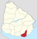
Gerona, Uruguay
Appearance
Gerona | |
|---|---|
Suburb of Pan de Azúcar | |
| Coordinates: 34°46′0″S 55°15′20″W / 34.76667°S 55.25556°W | |
| Country | |
| Department | Maldonado Department |
| Elevation | 79 m (259 ft) |
| Population (2011) | |
• Total | 679 |
| Time zone | UTC -3 |
| Postal code | 20300 |
| Dial plan | +598 443 (+5 digits) |
| Climate | Cfa |
Gerona is a populated centre and suburb of Pan de Azúcar in the southwest of the Maldonado Department in Uruguay.
Geography
[edit]The suburb is located about 2.5 kilometres (1.6 mi) west of Pan de Azúcar and about the same distance north of Ruta Interbalnearia.
Population
[edit]In 2011 Gerona had a population of 679.[1]
| Year | Population |
|---|---|
| 1975 | 329 |
| 1985 | 408 |
| 1996 | 459 |
| 2004 | 506 |
| 2011 | 679 |
Source: Instituto Nacional de Estadística de Uruguay[2]
See also
[edit]References
[edit]- ^ "Censos 2011 Maldonado (needs flash plugin)". INE. 2012. Archived from the original on 7 September 2012. Retrieved 29 August 2012.
- ^ "1963–1996 Statistics / G" (DOC). Instituto Nacional de Estadística de Uruguay. 2004. Retrieved 26 July 2011.
External links
[edit]


