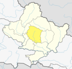
Dhital, Nepal
Appearance
Dhital, Nepal
धिताल | |
|---|---|
Tourism Village | |
| Coordinates: 28°19′N 83°53′E / 28.31°N 83.89°E | |
| Rural Municipality | Machhapuchhre Rural municipality |
| Zone | Gandaki Zone |
| District | Kaski District |
| Government | |
| • Type | Local Government |
| • Mayor | Min Bahadur Gurung |
| • Chairman | Teknath Gautam |
| Population (1991) | |
• Total | 4,121 |
| Time zone | UTC+5:45 (Nepal Time) |
Dhital, formerly a village development committee in Kaski District, Gandaki Zone, is now located in Machhapuchhre rural municipality, ward number 6 in Kaski district, Gandaki Province, Nepal.The name Dhital Dhi+Tal Dhi means nepali word धि and Tal means lake it is believed that there was a lake in 18th century. At the 1991 Nepal census, it had a population of 4,121 persons in 862 individual households.[1] Dhital is near Annapurna Himalaya and on its trekking route.


References
[edit]- ^ "Nepal Census 2001". Nepal's Village Development Committees. Digital Himalaya. Archived from the original on 12 October 2008. Retrieved 30 September 2008.
External links
[edit]


