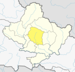
Deurali, Kaski
Appearance
Deurali
देउराली | |
|---|---|
Village Development Committee | |
| Deurali | |
 | |
| Country | |
| Zone | Gandaki Zone |
| District | Kaski District |
| Elevation | 3,200 m (10,500 ft) |
| Population (1991) | |
• Total | 2,882 |
| Time zone | UTC+5:45 (Nepal Time) |
Deurali is a Village Development Committee in Kaski District of the Gandaki province of north-central Nepal. At the time of the 1991 Nepal census, it had a population of 2,882.[1] The base camp of Mount Machapuchare is situated at a 6-hour uphill trek from the village.
Being the furthest human-settled village en route to the Machapuchare base camp, Deurali falls in an avalanche-prone region with the most recent incident of human casualty reported on January 17, 2020.[2]
References
[edit]- ^ "Nepal Census 2001". Nepal's Village Development Committees. Digital Himalaya. Archived from the original on 12 October 2008. Retrieved 30 September 2008.
- ^ "Six trekkers including 4 Koreans missing in avalanche in Annapurna region". The Himalayan Times. 2020-01-18. Retrieved 2020-01-19.
External links
[edit]28°7′N 84°10′E / 28.117°N 84.167°E

