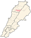
Bazoun
Appearance
Bazoun
بزعون | |
|---|---|
Village | |
| Coordinates: 34°14′29″N 35°59′15″E / 34.2414071°N 35.9874816°E | |
| Country | |
| Governorate | North Governorate |
| District | Bsharri District |
| Area | |
| • Total | 2.27 km2 (0.88 sq mi) |
| Elevation | 1,390 m (4,560 ft) |
| Time zone | UTC+2 (EET) |
| • Summer (DST) | UTC+3 (EEST) |
| Dialing code | +06 |
Bazoun (also spelled Bazaoun or Bazaaoun) (Arabic: بزعون) is a Maronite village and municipality in the Bsharri District of Lebanon.[1] Oral tradition has it that the first Lebanese settler in Guadeloupe was someone from the Debs family in Bazoun who went there in 1870.[2] There are 4 schools in the town, 3 public and 1 private, with almost 850 students in total attending.[3]
References
[edit]- ^ "List of Lebanese municipalities (may 2016) | Drupal". www.libandata.org. Retrieved 2023-03-24.
- ^ "THE LEBANESE IN GUADELOUPE" (PDF). ndu.edu.lb.
- ^ Localiban. "Bazaaoun - Localiban". www.localiban.org. Retrieved 2023-03-24.


