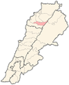
Barhalyoun
Appearance
Barhalyoun
برحليون | |
|---|---|
Town | |
| Coordinates: 34°15′32″N 35°52′34″E / 34.2589348°N 35.8761941°E | |
| Country | |
| Governorate | North Governorate |
| District | Bsharri District |
| Elevation | 1,000 m (3,000 ft) |
| Highest elevation | 1,225 m (4,019 ft) |
| Lowest elevation | 950 m (3,120 ft) |
| Population | |
• Total | 2,000+ |
| Time zone | UTC+2 (EET) |
| • Summer (DST) | UTC+3 (EEST) |
| Dialing code | +06 |
Barhalyoun or Barhalioun (Arabic: برحليون) is a town in the Bsharri District, North Governorate of Lebanon.[1][2][3][4][5][6][7]
References
[edit]- ^ "Liste des municipalités libanaises (mai 2016) | Libandata.org". 2019-02-09. Archived from the original on 2019-02-09. Retrieved 2023-03-06.
- ^ "Barhalioun - Barhalyoun". wikimapia.org. Retrieved 2023-03-07.
- ^ "معلومات عن بلدة برحليون - Barhalioun، قضاء بشري في محافظة الشمال، حسب لوائح الناخبين الرسمية الصادرة عن وزارة الداخلية اللبنانية لسنة ٢٠١٤". إعْرَفْ لبنان. Retrieved 2023-03-20.
- ^ "Six members from Barhalioun municipal council resign". LBCIV7. Retrieved 2023-03-20.
- ^ "بـــرحليون". الموقع الرسمي للجيش اللبناني (in Arabic). Retrieved 2023-03-20.
- ^ "Barhalioun". www.loubnaninfo.com. Retrieved 2023-03-20.
- ^ http://ims.prodeslebanon.org/wp-content/uploads/2018/12/FINAL-REPORT-BCHARRE-2010.pdf


