Åmarken railway station
Appearance
| S-train station | |||||||||||
 Åmarken station in 2007 | |||||||||||
| General information | |||||||||||
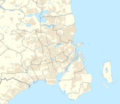
| Location | Åmarkvej 2 2650 Hvidovre[1] Hvidovre Municipality Denmark | ||||||||||
| Coordinates | 55°38′24″N 12°30′00″E / 55.640°N 12.500°E | ||||||||||
| Elevation | 4.2 metres (14 ft)[2] | ||||||||||
| Owned by | DSB | ||||||||||
| Platforms | Island platform | ||||||||||
| Tracks | 2 | ||||||||||
| History | |||||||||||
| Opened | 1972 | ||||||||||
| Services | |||||||||||
| |||||||||||
| |||||||||||
Åmarken station is an S-train railway station serving the southeastern part of the suburb of Hvidovre west of Copenhagen, Denmark.[1] It is located on the Køge radial of Copenhagen's S-train network.[3]

See also
[edit]References
[edit]This article needs additional citations for verification. (August 2024) |
- ^ a b "Åmarken Station" (in Danish). DSB. Retrieved 3 August 2024.
- ^ "Åmarken S-togstrinbræt (Åm)". danskejernbaner.dk (in Danish). Retrieved 13 December 2024.
- ^ "S-tog" (in Danish). DSB. Retrieved 3 August 2024.
External links
[edit]Wikimedia Commons has media related to Åmarken Station.
- (in Danish) Banedanmark – government agency responsible for maintenance and traffic control of most of the Danish railway network
- (in Danish) DSB – the Danish national train operating company
- (in Danish) Danske Jernbaner – website with information on railway history in Denmark


