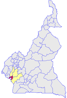
Wouri (department)
Appearance
Wouri | |
|---|---|
 Department location in Cameroon | |
| Coordinates: 4°3′19″N 9°45′43″E / 4.05528°N 9.76194°E | |
| Country | |
| Province | Littoral Province |
| Capital | Douala |
| Area | |
• Total | 356 sq mi (923 km2) |
| Population (2007) | |
• Total | 1,798,737 |
| Time zone | UTC+1 (WAT) |
Wouri is a department of the Littoral Province in Cameroon. It forms the area around the major city of Douala, and is named after the major Wouri River. The department covers an area of 923 km2 and as of 2001 had a total population of 1,514,978.[1] For 2007 the estimate had risen to 1,798,737 (Institut national de la statistique).
References
[edit]- ^ "Departments of Cameroon". Statoids, obtained from Institut national de la statistique (Cameroun) - Annuaire statistique du Cameroun 2004. Retrieved April 27, 2009.

