Wikipedia:Today's featured article/requests/Cirrus cloud
Cirrus cloud
[edit]- This is the archived discussion of the TFAR nomination for the article below. Subsequent comments should be made on the appropriate discussion page (such as Wikipedia talk:Today's featured article/requests). Please do not modify this page.
The result was: scheduled for Wikipedia:Today's featured article/May 21, 2022 by Gog the Mild (talk) 15:14, 10 April 2022 (UTC)
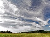
Cirrus clouds are atmospheric clouds characterized by thin, wispy strands, often bunched into tufts. They range in color from white to a faint gray and form when water vapor undergoes deposition at altitudes above 5,000 m (16,500 ft) in temperate regions and above 6,100 m (20,000 ft) in tropical regions. They also form from the outflow of tropical cyclones or the anvils of cumulonimbus clouds. Since these cirrus clouds arrive in advance of the frontal system or tropical cyclone, they indicate that the weather conditions may soon deteriorate. While they can indicate the arrival of precipitation, cirrus clouds themselves produce only fall streaks (falling ice crystals that evaporate before landing on the ground). Jet stream-powered cirrus clouds can grow long enough to stretch across continents, but they remain only a few kilometers deep. When visible light interacts with the ice crystals in cirrus clouds, it produces glories, sundogs, and fire rainbows. (Full article...)
- Most recent similar article(s): Climate change on Oct. 31, 2021
- Main editors: Reaper Eternal nominated the article at FAC, and was heavily involved in the FAR.
- Promoted: June 14, 2011. FAR closed as "Keep" on March 22, 2022.
- Reasons for nomination: This is a TFA rerun, with its last TFA on Sept. 29, 2011. Meteorology and climate are underrepresented at FA and TFA, except for storms and cyclones. There are no other weather phenomena at WP:FANMP. This level 4 vital article can be accompanied by a featured picture. The 2011 TFA blurb was a little long, so I cut the last sentence.
- Support as nominator. Z1720 (talk) 19:54, 25 March 2022 (UTC)
- Support. Gog the Mild (talk) 21:43, 6 April 2022 (UTC)

