Weetulta, South Australia
Appearance
This article needs additional citations for verification. (October 2015) |
| Weetulta South Australia | |||||||||||||||
|---|---|---|---|---|---|---|---|---|---|---|---|---|---|---|---|
 Uniting church at Weetulta, built in 1906 | |||||||||||||||
| Coordinates | 34°14′28″S 137°38′38″E / 34.24111°S 137.64389°E | ||||||||||||||
| Population | 69 (SAL 2021)[1] | ||||||||||||||
| Postcode(s) | 5573 | ||||||||||||||
| Location | |||||||||||||||
| LGA(s) | Yorke Peninsula Council | ||||||||||||||
| Region | Yorke and Mid North[2] | ||||||||||||||
| County | Daly[3] | ||||||||||||||
| State electorate(s) | Narungga[4] | ||||||||||||||
| Federal division(s) | Grey[5] | ||||||||||||||
| |||||||||||||||
| Footnotes | Adjoining localities[6] | ||||||||||||||
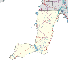
Weetulta is a locality in the Australian state of South Australia located on the Yorke Peninsula. The locality is in the Yorke Peninsula Council local government area, 162 kilometres (101 mi) west of the state capital, Adelaide.[6]
See also
[edit]References
[edit]- ^ Australian Bureau of Statistics (28 June 2022). "Weetulta (suburb and locality)". Australian Census 2021 QuickStats. Retrieved 28 June 2022.
- ^ "Yorke and Mid North SA Government region" (PDF). The Government of South Australia. Retrieved 17 April 2017.
- ^ "Search result(s) for Weetulta (LOCB) (Record No. SA0019017) with the following layers being selected – "Suburbs and Localities", "Counties", "Hundreds", "Place names (gazetteer)" and "Road labels"". Property Location Browser. Government of South Australia. Retrieved 28 April 2017.
- ^ Narungga (Map). Electoral District Boundaries Commission. 2016. Retrieved 1 March 2018.
- ^ "Federal electoral division of Grey" (PDF). Australian Electoral Commission. Retrieved 24 July 2015.
- ^ a b "New Ward Structure 2014". Yorke Peninsula Council. Retrieved 21 October 2015.
Wikimedia Commons has media related to Weetulta, South Australia.

