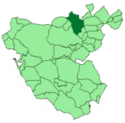
Villamartín
Appearance
You can help expand this article with text translated from the corresponding article in Spanish. (August 2024) Click [show] for important translation instructions.
|
Villamartín, Spain | |
|---|---|
 Location of Villamartín | |
| Coordinates: 36°52′N 5°39′W / 36.867°N 5.650°W | |
| Country | |
| Autonomous Community | |
| Municipality | Cádiz |
| Comarca | Sierra de Cádiz |
| Government | |
| • Mayor | Juan Luis Morales Gallardo (AxSí) |
| Area | |
• Total | 211.42 km2 (81.63 sq mi) |
| • Land | 211.42 km2 (81.63 sq mi) |
| • Water | 0.00 km2 (0.00 sq mi) |
| Population (2023)[4] | |
• Total | 12,165 |
| • Density | 58/km2 (150/sq mi) |
| Time zone | UTC+1 (CET) |
| • Summer (DST) | UTC+2 (CEST) |
| Postal code | 11650 |
| Website | www |
Villamartín is a city located in the province of Cádiz, Spain. According to the 2023 Register, the city has a population of 12,165 inhabitants.[4] It is the location of Castle of Matrera.
Demographics
[edit]| Year | Pop. | ±% |
|---|---|---|
| 2001 | 11,954 | — |
| 2002 | 12,069 | +1.0% |
| 2003 | 12,069 | +0.0% |
| 2004 | 12,038 | −0.3% |
| 2005 | 12,145 | +0.9% |
| 2006 | 12,291 | +1.2% |
| 2007 | 12,362 | +0.6% |
| Source: INE (Spain) | ||
References
[edit]- ^ "Equipo de Gobierno". www.villamartin.es. Retrieved 16 August 2024.
- ^ "Villamartín: 40 años haciendo municipalismo". Diario de Cádiz (in Spanish). 24 February 2020. Retrieved 16 August 2024.
- ^ "Entidades Locales". ssweb.seap.minhap.es. Retrieved 16 August 2024.
- ^ a b "Instituto Nacional de Estadística. (Spanish Statistical Institute)". www.ine.es. Retrieved 16 August 2024.
External links
[edit]Wikimedia Commons has media related to Villamartín.
- Villamartín - Sistema de Información Multiterritorial de Andalucía
- Panorámicas de Villamartín - Panorámicas de Villamartín


