Varenne-Saint-Germain
Varenne-Saint-Germain | |
|---|---|
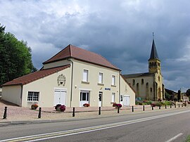
 The town hall in Varenne-Saint-Germain | |
| Coordinates: 46°25′47″N 4°01′34″E / 46.4297°N 4.0261°E | |
| Country | France |
| Region | Bourgogne-Franche-Comté |
| Department | Saône-et-Loire |
| Arrondissement | Charolles |
| Canton | Digoin |
| Area 1 | 15.62 km2 (6.03 sq mi) |
| Population (2021)[1] | 703 |
| • Density | 45/km2 (120/sq mi) |
| Time zone | UTC+01:00 (CET) |
| • Summer (DST) | UTC+02:00 (CEST) |
| INSEE/Postal code | 71557 /71600 |
| Elevation | 227–278 m (745–912 ft) (avg. 240 m or 790 ft) |
| 1 French Land Register data, which excludes lakes, ponds, glaciers > 1 km2 (0.386 sq mi or 247 acres) and river estuaries. | |
Varenne-Saint-Germain (French pronunciation: [vaʁɛn sɛ̃ ʒɛʁmɛ̃]) is a commune in the Saône-et-Loire department in the region of Bourgogne-Franche-Comté in eastern France.
Geography
[edit]Varenne-Saint-Germain is bordered by the Digoin commune to the north, Vitry-en-Charollais to the east, Saint-Yan to the south and Chassenard to the west. The Arconce flows north-northwest through the middle of the commune, then flows into the Loire, which forms parts of the commune's western border.
History
[edit]In 1793, during the French Revolution, Reuillon, hamlet of Varennes-Reuillon, was renamed to La Montagne.[2] During the Second World War, the commune was crossed by the demarcation line; the remains of a border post are still present on the road D982. The commune of Varenne-Saint-Germain was created in 1973 by merging the communes of Saint-Germain-des-Rives and Varenne-Reuillon.
Demographics
[edit]In 2018, the commune had 718 inhabitants, an increase of 5.43% compared to 2013.
Sights
[edit]- Château de Pontamailly, former property of Nicolas du Bessey de Contenson (who had bought the barony of Pontamailly in 1771). The remains of the castle were largely rebuilt in 1875.[3]
- La Motte-Reuillon castle mound, whose central platform measures about 30 meters in diameter and where the remains of a tower remain.[4]
See also
[edit]References
[edit]- ^ "Populations légales 2021" (in French). The National Institute of Statistics and Economic Studies. 28 December 2023.
- ^ E. Lauxeur, Les changements de noms des communes de Saône-et-Loire pendant la Révolution, article published in the review "Images de Saône-et-Loire" No. 4, April 1970, pages 9-13.
- ^ Paul Chaussard, Au secours des Américains, article published in the review "Images de Saône-et-Loire" No. 135, September 2003, pages 21-23
- ^ Paul Chaussard, À propos de mottes féodales en pays digoinais, article published in the review "Images de Saône-et-Loire" No. 65, 1986, pages 3-7


