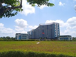
Vĩnh Long province
Vĩnh Long | |
|---|---|
 | |
| Nickname: Eternal prosperity | |
 Location of Vĩnh Long within Vietnam | |
 | |
| Coordinates: 10°10′N 106°0′E / 10.167°N 106.000°E | |
| Country | |
| Region | Mekong Delta |
| Capital | Vĩnh Long |
| Government | |
| • People's Council Chair | Bùi Văn Nghiêm |
| • People's Committee Chair | Lữ Quang Ngời |
| Area | |
| • Total | 1,525.73 km2 (589.09 sq mi) |
| Population (2023) | |
| • Total | 1,329,630 |
| • Density | 870/km2 (2,300/sq mi) |
| Demographics | |
| • Ethnicities | Vietnamese, Khmer, Hoa, Chăm |
| GDP[2] | |
| • Total | VND 47.121 trillion US$ 2.047 billion |
| Time zone | UTC+7 (ICT) |
| Calling code | 70 |
| ISO 3166 code | VN-49 |
| HDI (2020) | (29th) |
| Website | vinhlong |
Vĩnh Long is a province located in the Mekong Delta of southwestern Vietnam. Its capital is Vĩnh Long. Its population is 1,046,390 and its area is 1,525.73 km2 (589.09 sq mi).[1] Vĩnh Long (spelled 永隆 in the former Hán-Nôm writing system) is a Sino-Vietnamese name, translating as "eternal prosperity." This province covers the central part of the largest delta island in Vietnam, and also on the western tip of the southern river island of Bến Tre Province.
Administrative history
[edit]
Modern-day Vĩnh Long was part of Long Hồ dinh (barrack, 營) established by the Nguyễn lords in 1732, comprising the provinces of Bến Tre, Trà Vinh, and parts of Cần Thơ.
The area saw some of the heaviest fighting between the Tây Sơn brothers and the Nguyễn lords in the late 18th century; in 1784 Nguyễn Huệ defeated Siamese forces aiding Nguyễn Ánh at the Mang Thít River.
In 1951, the Southern Resistance Administrative Committee of the Democratic Republic of Vietnam merged Vĩnh Long and Trà Vinh provinces into Vĩnh Trà province. Vinh Tra existed until 1954 (however, as North Vietnam never administered the area for a significant period of time, this arrangement was not enforced). In 1957, the South Vietnam formed Vĩnh Long province, consisting of six districts: Châu Thành, Chợ Lách (now part of Bến Tre province), Tam Bình, Bình Minh, Sa Đéc, and Lấp Vò. In 1961, Cái Nhum District was split from Chợ Lách. Đức Tôn District and Đức Thành District were added in 1962, but joined the newly formed Sa Đéc province in 1966. As of 1975, the province had seven districts: Châu Thành, Chợ Lách, Tam Bình, Bình Minh, Minh Đức, Trà Ôn, and Vũng Liêm.
After the fall of South Vietnam, the Socialist Republic of Vietnam merged Vĩnh Long with Trà Vinh province, forming Cửu Long province in 1976. In 1991, Cửu Long was again split into Vĩnh Long and Trà Vinh. At the time of the split, Vĩnh Long province consisted of one city (Vĩnh Long) and five districts: Long Hồ, Vũng Liêm, Bình Minh, Tam Bình, and Trà Ôn.
In 1992, Mang Thít District was re-split from Long Hồ District. In 2007, Bình Tân District was created.
On April 10, 2009, the Vietnamese Government issued Decree No. 16/ND-CP establishing Vĩnh Long City in Vĩnh Long Province, based on the entire natural area and population of Vĩnh Long Town.[4]
Geography
[edit]Lying between the Hau and Tien rivers in the center of the Mekong Delta, Vĩnh Long is a province well known for fishing.
Administrative divisions
[edit]Vĩnh Long is subdivided into eight district-level sub-divisions:
- 6 districts:
They are further subdivided into five commune-level towns (or townlets), 94 communes, and 10 wards.
Economy
[edit]Prawns and the Basa and Tra catfish are among the many types of fish that exist in abundance in the waters of Vĩnh Long. Its rich, fertile soil makes Vĩnh Long an ideal location for the growing of many exotic and delicious fruits, including the strange-looking mangosteen, the spikey rambutan and the pungently fragrant durian. Because of Vĩnh Long's extensive network of waterways, these fruits and many other items can be purchased for mere pennies from the huge water-based squadron of floating merchants.
Traveling by water is a common practice here for such mundane tasks as grocery shopping as well as getting to restaurants and tourist attractions located on small islets accessible only by boat. Tourist infrastructure is still in its infancy here, but comfortable lodging and great food can be had for very reasonable prices.
Transportation
[edit]Located approximately 135 kilometres (84 mi) southwest of Hồ Chí Minh City, Vĩnh Long is easily accessible by bus, van or car using National Route 1 and the Mỹ Thuận Bridge.
Notable Vĩnh Long residents
[edit]Gallery
[edit]-
Ngọc Viên Ancestral Temple Vietnamese Mendicant Buddhist Sect
-
Statue of Guanyin of the Nine Dragons
-
Công Thần Temple
-
Vĩnh Long Cathedral
-
Văn Thánh Temple
References
[edit]- ^ a b Biểu số 4.6: Hiện trạng sử dụng đất vùng Đồng Bằng Sông Cửu Long năm 2022 [Table 4.6: Current land use status in the Mekong Delta in 2022] (PDF) (Decision 3048/QĐ-BTNMT) (in Vietnamese). Ministry of Natural Resources and Environment (Vietnam). 18 October 2023. – the data in the report are in hectares, rounded to integers
- ^ "Tình hình kinh tế, xã hội Vĩnh Long năm 2018". Cổng thông tin điện tử tỉnh Vĩnh Long. Retrieved 10 May 2020.
- ^ "Human Development Index by province(*) by Cities, provincies and Year". General Statistics Office of Vietnam. Retrieved September 28, 2024.
- ^ "Thành lập thành phố Vĩnh Long". baocantho.com.vn (in Vietnamese). Retrieved 2024-11-05.


