User:Vigneshdm1990/sandbox
Appearance
Climate maps
[edit]


Natural resources maps
[edit]


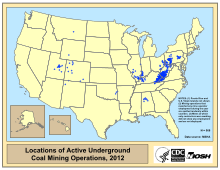


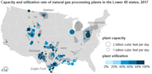
Energy maps
[edit]



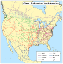
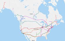
Transportation maps
[edit]




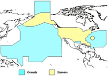
UK
[edit]- Item
Administrative Maps
[edit]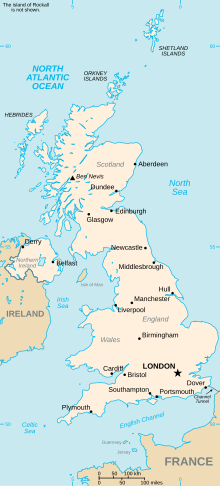


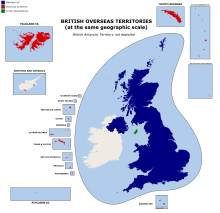


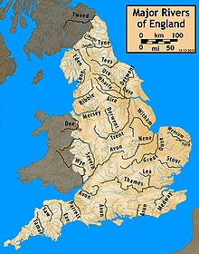
Physical Maps
[edit]

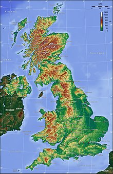

Climate Maps
[edit]
Environmental Maps
[edit]
Natural Resources Maps
[edit]


Agriculture Maps
[edit]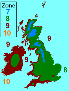
Energy Maps
[edit]Transportation Maps
[edit]


Cultural Maps
[edit]Crystal structure
[edit]| Element | Type | Symbol | Atomic number | Atomic weight (amu) | Density (g/cm^3) | Crystal structure at 20° C | Atomic radius (nm) | Ionic radius (nm) | Melting point (°C) |
|---|---|---|---|---|---|---|---|---|---|
| Hydrogen | Non metal | H | 1 | 1.008 | 0.154 | -259 | |||
| Helium | Noble gas | He | 2 | 4.003 | -272 (at 26 atm) | ||||
| Lithium | Alkali metal | Li | 3 | 6.94 | 0.534 | BCC | 0.152 | 0.068 | 181 |
| Beryllium | Alkaline earth metal | Be | 4 | 9.012 | 1.85 | HCP | 0.114 | 0.035 | 1278 |
| Boron | Metalloid | B | 5 | 10.81 | Rhomb. | 0.023 | 2300 | ||
| Carbon | Non metal | C | 6 | 12.011 | 2.25 | Hex. | 0.071 | -0.016 | (sublimes at 3367) |
| Nitrogen | Non metal | N | 7 | 14.007 | 0.01--0.02 | -209.9 | |||
| Oxygen | Non metal | O | 8 | 16 | 0.14 | -218.4 | |||
| Fluorine | Non metal | F | 9 | 19 | 0.133 | -220 | |||
| Neon | Noble gas | Ne | 10 | 20.18 | -248.7 | ||||
| Sodium | Alkali metal | Na | 11 | 22.99 | 0.971 | BCC | 0.186 | 0.102 | 98 |
| Magnesium | Alkaline earth metal | Mg | 12 | 24.31 | 1.74 | HCP | 0.16 | 0.072 | 649 |
| Aluminum | Post transition metal | Al | 13 | 26.98 | 2.71 | FCC | 0.143 | 0.053 | 660.4 |
| Silicon | Metalloid | Si | 14 | 28.09 | 2.33 | Dia.cubic | 0.118 | 0.04 | 1410 |
| Phosphorus | Non metal | p | 15 | 30.97 | 1.82 | Ortho. | 0.109 | 0.035 | 44.1 |
| Sulfur | Non metal | S | 16 | 32.06 | 2.07 | Ortho. | 0.106 | 0.184 | 113 |
| Chlorine | Non metal | Cl | 17 | 35.45 | 0.181 | -101 | |||
| Argon | Noble gas | Ar | 18 | 39.95 | -189.2 | ||||
| Potassium | Alkali metal | K | 19 | 39.1 | 0.862 | BCC | 0.231 | 0.138 | 63 |
| Calcium | Alkaline earth metal | Ca | 20 | 40.08 | 1.55 | FCC | 0.197 | 0.1 | 839 |
| Titanium | Transition metal | Ti | 22 | 47.87 | 4.51 | HCP | 0.145 | 0.068 | 1668 |
| Vanadium | Transition metal | V | 23 | 50.94 | 6.1 | BCC | 0.132 | 0.059 | 1890 |
| Chromium | Transition metal | Cr | 24 | 52 | 7.19 | BCC | 0.125 | 0.063 | 1875 |
| Manganese | Transition metal | Mn | 25 | 54.94 | 7.44 | Cubic | 0.112 | 0.067 | 1244 |
| Iron | Transition metal | Fe | 26 | 55.85 | 7.87 | BCC | 0.124 | 0.077 | 1538 |
| Cobalt | Transition metal | Co | 27 | 58.93 | 8.9 | HCP | 0.125 | 0.072 | 1495 |
| Nickel | Transition metal | Ni | 28 | 58.69 | 8.9 | FCC | 0.125 | 0.069 | 1455 |
| Copper | Transition metal | Cu | 29 | 63.55 | 8.94 | FCC | 0.128 | 0.096 | 1085 |
| Zinc | Transition metal | Zn | 30 | 65.41 | 7.13 | HCP | 0.133 | 0.074 | 420 |
| Gallium | Post transition metal | Ga | 31 | 69.72 | 5.9 | Ortho. | 0.122 | 0.062 | 29.8 |
| Germanium | Metalloid | Ge | 32 | 72.64 | 5.32 | Dia. cubic | 0.122 | 0.053 | 937 |
| Bromine | Non metal | Br | 35 | 79.9 | 0.196 | -7.2 | |||
| Zirconium | Transition metal | Zr | 40 | 91.22 | 6.51 | HCP | 0.159 | 0.079 | 1852 |
| Niobium | Transition metal | Nb | 41 | 92.91 | 8.57 | BCC | 0.143 | 0.069 | 2468 |
| Molybdenum | Transition metal | Mo | 42 | 95.94 | 10.22 | BCC | 0.136 | 0.07 | 2617 |
| Silver | Transition metal | Ag | 47 | 107.87 | 10.49 | FCC | 0.144 | 0.126 | 962 |
| Cadmium | Transition metal | Cd | 48 | 112.41 | 8.65 | HCP | 0.149 | 0.095 | 321 |
| Tin | Post transition metal | Sn | 50 | 118.71 | 7.27 | Tetra. | 0.151 | 0.071 | 232 |
| Iodine | Non metal | I | 53 | 126.91 | 4.93 | Ortho. | 0.136 | 0.22 | 114 |
| Cesium | Alkali metal | Cs | 55 | 132.91 | 1.87 | BCC | 0.265 | 0.17 | 28.4 |
| Barium | Alkaline earth metal | Ba | 56 | 137.33 | 3.5 | BCC | 0.217 | 0.136 | 725 |
| Tungsten | Transition metal | W | 74 | 183.84 | 19.3 | BCC | 0.137 | 0.07 | 3410 |
| Platinum | Transition metal | Pt | 78 | 195.08 | 21.45 | FCC | 0.139 | 0.08 | 1772 |
| Gold | Transition metal | Au | 79 | 196.97 | 19.32 | FCC | 0.144 | 0.137 | 1064 |
| Mercury | Transition metal | Hg | 80 | 200.59 | 0.11 | -38.8 | |||
| Lead | Post transition metal | Pb | 82 | 207.2 | 11.35 | FCC | 0.175 | 0.12 | 327 |
Economics
[edit]- scarcity, supply and demand
- mind, Environment
- game, decision, action
- regulation, law, government, tragedy of commons
- Human centered, mental and physical Well being
- cycle of nutrients and matter. Energy.
- Production, distribution, consumption, saving/storage, investment of goods and services
- Investment, decision, risk
- cycle of money goods and growth
- finance: money, value of goods (supply and demand), exchange, value, storage, trust, promise, motivation, purchasing power,
- GDP, unemployment, Inflation, debt, interest rate
- Market: supply and demand, priced Determination, understanding trend, advertisement.
- human behavior, psychology, decision, incentives
- Banks: risk sharing, security, aids in transport of money, ideas meet idle, makes promise, gives trust,bank is money market
Codes
[edit]# Python code using matplotlib library to generate 72 images to create a gif file that shows
import matplotlib.pyplot as plt
import numpy as np
Printing first 10 Fibonacci numbers, functional expression style
Fibonacci/@Range[10]
ef[Pmat_, {d1_, d2_}, n_] := (\[Theta]i = ArcSin[Subscript[R, en] Sin[\[Theta]]/n];)
Or, alternatively, in a more functional programming approach:
If[# <= 2, 1, #0[# - 1] + #0[# - 2]] & /@ Range[10]
Notice the use of #0 to indicate the function itself.
Add1
[edit]| Column 1 | Column 2 | Column 3 |
|---|---|---|
| A | B | |
| C | D | |
| E | F | |
| G | ||
| H | ||
Physiographic regions of India
[edit]Based on R.L. Singh
[edit]| Macro Regions | Meso Regions | First Order Regions | Second Order Regions |
|---|---|---|---|
| A. Great Plains | I. Rajasthan Plain | 1. Marusthali | a. Jaisalmer Marusthali |
| b. Barmer Marusthali | |||
| c. Bikaner-Churu Marusthali | |||
| 2. Rajasthan Bagar | d. Ghaggar Plain | ||
| e. Shekhawati Region | |||
| f. Nagaur Region | |||
| g. Luni Basin | |||
| II. Punjab Plain | 3.Punjab Plain North | a. Hoshiarpur—Chandigarh Plain (Sub-Mountain belt) | |
| b. Upper Bari Doab | |||
| c. Jullundur Plain | |||
| d. Punjab Malwa | |||
| 4.Punjab Plain South | e. Ambala Plain (Sub-Mountain belt) | ||
| f. Eastern Haryana (Kurukshetra Plain) | |||
| g. Western Haryana | |||
| h. Southern Haryana | |||
| III. Upper Ganga Plain | 5.Upper Ganga Plain North | a. Rohilkhand Plain | |
| b. Awadh Plain | |||
| 6.Upper Ganga Plain South | c. Upper Ganga-Yamuna Doab | ||
| d. Trans-Yamuna Plain | |||
| e. Lower GangaYamuna Doab | |||
| IV. Middle Ganga Plain | 7.Middle Ganga Plain North | a. Ganga-Ghaghara Divide | |
| b. Saryupar Plain | |||
| c. Mithila Plain | |||
| d. Kosi Plain | |||
| 8.Middle Ganga Plain South | e. Son-Ganga Divide | ||
| f. Magadh-Anga Plain | |||
| V. Lower Ganga Plain | 9. North Bengal Plain | a. Duars (Barind Tract) | |
| b. Tista Flood plain | |||
| 10. Delta Proper | c. Moribund Delta | ||
| d. Mature Delta | |||
| e. Active Delta | |||
| 11. Rarh Plain | f. Mayurakshi Plain | ||
| g. Bankura Upland | |||
| h. Midnapur Upland | |||
| VI. Assam Valley | 12. Upper Assam Valley | a. Upper Assam Valley North | |
| b. Upper Assam Valley South | |||
| 13. Lower Assam Valley | c. Lower Assam Valley North | ||
| d. Lower Assam Valley South | |||
| B. Himalayan Mountain Region | VII. Kashmir Region | 14. Kashmir Region South | a. Kashmir Valley |
| b. Jammu-Mirpur Region | |||
| 15. Kashmir Region North | c. Zaskar-Ladakh Region | ||
| d. Deosai-Skardu Region | |||
| e. Gilgit-Baltistan Region | |||
| f. Aksaichin Region | |||
| VIII. Himachal Region | 16. Himalayan Himachal | a. Chandra Bhaga Basin | |
| b. Ravi Basin | |||
| c. Beas Basin | |||
| d. Himalayan Sutlej Basin | |||
| e. Upper Yamuna Tributary Basin | |||
| 17. Trans Himalayan Himachal | f. Spiti-Kalpa-Sutlej Basin | ||
| g. Malung Basin | |||
| IX. U.P. Himalaya | 18. Himadri | a. Himadri Ranges | |
| b. Himadri Valleys | |||
| 19. Himanchal | c. Trans-Yamuna Basin | ||
| d. Bhagirathi-Alaknanda Basin | |||
| e. Ramganga-Kosi Basin | |||
| f. Saryu-Kali Basin | |||
| 20. Siwaliks | g. Yamuna-Ganga Tract | ||
| h. Ganga-Ramganga Tract | |||
| i. Ramganga-Kali Tract | |||
| X. Eastern Himalaya | 21. Darjeeling-Sikkim-Bhutan-Himalaya | a. Darjeeling-Sikkim Himalaya | |
| b. Bhutan Himalaya | |||
| 22. Assam Himalaya | c. Dafla Region | ||
| d. Miri Region | |||
| e. Abor Region | |||
| f. Mishmi Region | |||
| XI. Purvanchal Region | 23. Purvanchal North | a. Lohit-Tirap Region | |
| b. Nagaland | |||
| 24. Purvanchal South | c. Manipur Region | ||
| d. Mizo Region | |||
| e. Tripura-Cachhar Region | |||
| C. Peninsular Uplands | XII. Udaipur-Gwalior Region | 25. Aravalli Uplands | a. North Aravalli Region |
| b. Central Aravalli Region | |||
| c. Southern Aravalli Region | |||
| 26. Chambal-Sindh Plains | d. Middle Chambal Basin | ||
| e. Lower Chambal Basin | |||
| f. Sindh Basin | |||
| XIII. Malwa Region | 27. Malwa Region North | a. Eastern Mahi Basin | |
| b. Upper Chambal Basin | |||
| c. Upper Betwa Basin | |||
| 28. Malwa Region South | d. Western Vindhyan | ||
| e. Middle Narmada Trough | |||
| f. Western Satpura | |||
| XIV. Bundelkhand Region | 29. Bundelkhand Plain | a. Ravine Belt | |
| b. Jalaun Plains | |||
| c. Hamirpur Plains | |||
| d. Banda Plains | |||
| 30. Bundelkhand Uplands | e. Bundelkhand Gneissic Region | ||
| f. Bundelkhand Vindhyan Plateau | |||
| XV. Vindhyanchal-Baghelkhand Region | 31. Vindhyanchal-Baghelkhand Region North | a. Rewa-Panna Plateau | |
| b. Mirzapur-Rohtasgarh plateau | |||
| 32. Vindhyanchal-Baghelkhand Region South | c. Baghelkhand | ||
| d. Chhindwara-Maikal Plateau | |||
| e. Narmada-Son Trough | |||
| XVI. Chotanagpur Region | 33. Chotanagpur Region North | a. Palamau Uplands | |
| b. Hazaribagh Plateau | |||
| c. Damodar Valley | |||
| d. Santhal Pargana Uplands | |||
| 34. Chotanagpur Region South | e. Pat Lands | ||
| f. Ranchi Plateau | |||
| g. South-Eastern Chotanagpur or Singhbhum Region | |||
| XVII. Meghalaya-Mikir Region | 35. Meghalaya-Mikir Region West | a. Garo Region North | |
| b. Garo Region South | |||
| 36. Meghalaya-Mikir Region Central | c. Khasi Region North | ||
| d. Khasi Region South | |||
| 37. Meghalaya-Mikir Region East | e. Jaintia Region | ||
| f. Mikir Region West | |||
| g. Mikir Region East | |||
| XVIII. Maharashtra Region | 38. Maharashtra Sahyadri | a. Maharashtra Sahyadri North | |
| b. Maharashtra Sahyadri South | |||
| 39. Tapti-Purna Valley | c. Tapti-Purna Valley West | ||
| d. Tapti-Purna Valley East | |||
| 40. Maharashtra Plateau | e. Ajanta Hills | ||
| f. Godavari Valley | |||
| g. Balaghat Upland | |||
| h. Upper Bhima Valley | |||
| i. Mahadeo Upland | |||
| 41. Vidarbha Plains | j. Wardha-Penganga Plain | ||
| k. Wainganga Plain | |||
| XIX. Chattisgarh Region | 42. Rim Land | a. Northern Rim Land | |
| b. Western Rim Land | |||
| c. Southern Rim Land | |||
| 43. Chattisgarh Plains | d. Raipur—Durg Plain | ||
| e. Bilaspur Plain | |||
| f. Raigarh Plain | |||
| XX. Orissa Highland Region | 44. North-Eastern Hill Region | a. North-Western Upland or Gangapur-Jharsuguda Basin | |
| b. Garhjat Hills | |||
| c. North-Eastern Plateau | |||
| 45. Middle Mahanadi Valley | d. Hirakud-Sonepur Valley Region | ||
| e. Baudh Valley Region | |||
| 46. South-Western Hill Region | f. Hirakud-Bolangir Basin | ||
| g. Orissa Ghats Region | |||
| XXI. Dandakaranya | 47. Dandakaranya Ghats | a. Dandakaranya Ghats East | |
| b. Dandakaranya Ghats Central | |||
| c. Dandakaranya Ghats West | |||
| 48. Dandakaranya Uplands | d. Tel-Jonk Valley Region | ||
| e. Bastar Upland | |||
| f. Indravati-Sabari Plain | |||
| XXII. Karnataka Plateau | 49. Malnad (Central Sahyadri) | a. North Malnad | |
| b. Central Malnad | |||
| c. South Malnad | |||
| 50. Maidan North | d. Bidar Plateau | ||
| e. Gulbarga Plain | |||
| f. Raichur Plain | |||
| g. Bellary Plain | |||
| h. Dharwar Plateau | |||
| i. Bijapur Region | |||
| 51. Maidan South | j. Chitradurga Region | ||
| k. Tumkur Region | |||
| l. Bangalore Region | |||
| m. Mysore Region | |||
| XXIII. Andhra Plateau | 52. Telangana | a. Hyderabad Plateau | |
| b. Telangana Peneplain | |||
| c. Godavari Valley | |||
| d. Krishna Valley | |||
| 53. Rayalaseema | e. Rayalaseema Peneplain | ||
| f. Rayalaseema Plateau | |||
| 54. Andhra Ghats | g. Northern Andhra Ghats | ||
| h. Southern Andhra Ghats | |||
| XXIV. Tamilnadu Uplands & South Sahyadri | 55. South Sahyadri | a. Anaimalai-Palni Hills | |
| b. Cardamom Hills | |||
| c. Agastyamalai Hills | |||
| 56. Tamilnadu Ghats | d. Nilgiris | ||
| e. Mettur-Vellore Region | |||
| f. Tamilnadu Hills | |||
| 57. Coimbatore-Madurai Uplands | g. Coimbatore Uplands | ||
| h. Madurai Uplands | |||
| D. The Indian Coasts and Islands | XXV. Gujarat Region | 58. Gujarat Region West | a. Bhuj Region |
| b. Kathiwar Region | |||
| 59. Gujarat Region East | c. Ahmedabad Region | ||
| d. Khambhat Region (Cambay Region) | |||
| e. Eastern Hilly Region | |||
| XXVI. West Coast Region | 60. Konkan Coast | a. Konkan Coast North | |
| b. Konkan Coast South | |||
| 61. Karnataka Coast | c. North Kanara | ||
| d. South Kanara | |||
| 62. Malabar Coast | e. Malabar Coast North | ||
| f. Malabar Coast South | |||
| XXVII. East Coastal Plains | 63. Tamilnadu Coastal Plain | a. Southern Plain or Vaigai-Tambraparni Region | |
| b. Delta Region | |||
| c. Palar-Ponnaiyar Plain Region | |||
| 64. Andhra Coastal Plain | d. Pennar (Nellore) Region | ||
| e. Krishna-Godavari Delta | |||
| f. Vishakhapatnam Region | |||
| 65. Utkal Coastal Plain | g. Chilka Region | ||
| h. Mahanadi Delta | |||
| i. Balasore Plain | |||
| XXVIII. The Indian Islands | 66. Arabian sea Islands | a. Amindivi Islands | |
| b. Laccadive Islands | |||
| c. Minicoy Island | |||
| 67. Bay Islands | d. Andaman Islands | ||
| e. Nicobar Islands |
S.P. Chatterjee
[edit]| Divisions | Sub-divisions | Provinces | Sections and Sub-sections |
|---|---|---|---|
| I. The Northern Mountains | 1. Western Himalaya | a. North Kashmir Himalaya | a. North Kashmir Himalaya |
| b. South Kashmir Himalaya | b. South Kashmir Himalaya | ||
| c. Punjab Himalaya | c. Punjab Himalaya | ||
| d. Kumaun Himalaya | d. Kumaun Himalaya | ||
| 2. Central Himalaya | a. West Central Himalaya | ||
| b. East Central Himalaya | |||
| 3. Eastern Himalaya | a. Eastern Himalaya (West) | ||
| b. Eastern Himalaya (East) | |||
| 4. Northeastern Ranges | a. Purvachal | ||
| b. Meghalaya | |||
| c. Assam Valley | |||
| II. The Great Plains | 5. Western Plains | a. Marusthali | |
| b. Rajasthan Bagar | |||
| 6. Northern Plains | a. Punjab Plains | ||
| b. Ganga-Yamuna Doab | |||
| c. Rohilkhand Plains | |||
| d. Avadh Plains | |||
| 7. Eastern Plains | a. North Bihar Plains | ||
| b. South Bihar Plains | |||
| c. North Bengal Plains | |||
| d. Bengal Basin |
Add2
[edit]Add3
[edit]Template
[edit]This template's initial visibility currently defaults to autocollapse, meaning that if there is another collapsible item on the page (a navbox, sidebar, or table with the collapsible attribute), it is hidden apart from its title bar; if not, it is fully visible.
To change this template's initial visibility, the |state= parameter may be used:
{{Vigneshdm1990|state=collapsed}}will show the template collapsed, i.e. hidden apart from its title bar.{{Vigneshdm1990|state=expanded}}will show the template expanded, i.e. fully visible.


