User:Nyttend/Virginia NRHP/DC
Appearance
NRHP in Virginia by county Counties 1 • 2 • 3 • 4 • 5 • 6 • 7 • 8 • 9 • 10 • 11 • 12 • 13 • 14 • 15 • 16 • 17 • 18 • 19 • 20 • 21 • 22 • 23 • 24 • 25 • 26 • 27 • 28 • 29 • 30 • 31 • 32 • 33 • 34 • 35 • 36 • 37 • 38 • 39 • 40 • 41 • 42 • 43 • 44 • 45 • 46 • 47 • 48 • 49 • 50 • 51 • 52 • 53 • 54 • 55 • 56 • 57 • 58 • 59 • 60 • 61 • 62 • 63 • 64 • 65 • 66 • 67 • 68 • 69 • 70 • 71 • 72 • 73 • 74 • 75 • 76 • 77 • 78 • 79 • 80 • 81 • 82 • 83 • 84 • 85 • 86 • 87 • 88 • 89 • 90 • 91 • 92 • 93 • 94 • 95 Cities 1 • 2 • 3 • 4 • 5 • 6 • 7 • 8 • 9 • 10 • 11 • 12 • 13 • 14 • 15 • 16 • 17 • 18 • 19 • 20 • 21 • 22 • 23 • 24 • 25 • 26 • 27 • 28 • 29 • 30 • 31 • 32 • 33 • 34 • 35 • 36 • 37 • 38 |
| [1] | Name on the Register | Image | Date listed[2] | Location | Neighborhood | Description |
|---|---|---|---|---|---|---|
| 17 | Auditor's Building Complex |  |
April 27, 1978 (#78003051) |
14th St. and Independence Ave. 38°53′10″N 77°02′01″W / 38.886111°N 77.033611°W | SW | |
| 52 | District of Columbia Municipal Center and Plaza |  |
July 19, 2019 (#100004189) |
300 Indiana Ave. NW (301 C St. NW) 38°53′38″N 77°01′03″W / 38.8939°N 77.0176°W | ||
| 64 | The Ethelhurst |  |
June 26, 2019 (#100004123) |
1025 Fifteenth St., NW 38°54′13″N 77°02′04″W / 38.9036°N 77.0345°W | ||
| 83 | Harbour Square |  |
November 28, 2018 (#100003158) |
400-560 (even) N St. SW, 1301-1327 (odd) 4th St, SW 38°52′26″N 77°01′04″W / 38.8740°N 77.0179°W | Southwest Waterfront | |
| 91 | Lyndon Baines Johnson Memorial Grove On The Potomac |  |
December 28, 1973 (#73002097) |
Lady Byrd Johnson Park, Columbia Island 38°52′42″N 77°03′05″W / 38.878333°N 77.051389°W | SW | |
| 117 | Mount Vernon Memorial Highway |  |
May 18, 1981 (#81000079) |
Washington St. and George Washington Memorial Pkwy. 38°52′38″N 77°02′56″W / 38.877222°N 77.048861°W | SW | Extends into Alexandria, Virginia |
| 142 | PHILADELPHIA (gundelo) | 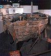 |
October 15, 1966 (#66000852) |
National Museum of American History, 14th St. and Constitution Ave., NW 38°53′29″N 77°01′48″W / 38.891389°N 77.030000°W | Monumental Core | Only surviving American gunboat from the Revolutionary War, fought in Battle of Valcour Island |
| 164 | Southeast No. 9 Boundary Marker of the Original District of Columbia |  |
November 1, 1996 (#96001242) |
0.225 mile south of the Oxon Cove Bridge and 420 feet east of Shepherd Parkway 38°48′14″N 77°01′27″W / 38.803889°N 77.024167°W | SE | |
| 196 | USS SEQUOIA (yacht) |  |
December 23, 1987 (#87002594) |
Gangplank Marina (as of 2010) 38°52′32″N 77°01′21″W / 38.875556°N 77.0225°W | SW |
| [1] | Name on the Register | Image | Date listed[2] | Location | Neighborhood | Description |
|---|---|---|---|---|---|---|
| 1 | Alban Towers Apartment Building |  |
September 9, 1994 (#94001040) |
3700 Massachusetts Ave., NW. 38°55′43″N 77°04′26″W / 38.928611°N 77.073889°W | Cathedral Heights | |
| 3 | Babcock-Macomb House |  |
February 10, 1995 (#94001633) |
3415 Massachusetts Ave., NW. 38°55′29″N 77°04′04″W / 38.924722°N 77.067778°W | Massachusetts Heights | |
| 10 | Capital Traction Company Union Station |  |
August 9, 2019 (#100004248) |
3600 M Street NW 38°54′18″N 77°04′11″W / 38.9051°N 77.0697°W | Georgetown | |
| 11 | Castle Gatehouse, Washington Aqueduct |  |
March 13, 1975 (#75002048) |
Near jct. of Reservoir Rd. and MacArthur Blvd., NW. 38°54′39″N 77°05′24″W / 38.910833°N 77.09°W | Foxhall | |
| 13 | The Causeway |  |
June 28, 1990 (#90000910) |
3029 Klingle Rd., NW. 38°55′54″N 77°03′40″W / 38.931667°N 77.061111°W | Cleveland Park | Also known as Tregaron |
| 14 | Chain Bridge Road School |  |
December 9, 2003 (#03001255) |
2820 Chain Bridge Rd. 38°55′45″N 77°05′48″W / 38.929167°N 77.096667°W | NW | |
| 21 | Cleveland Park Historic District |  |
April 27, 1987 (#87000628) |
Roughly bounded by Tilden St., Connecticut Ave., Klingle Rd., and Wisconsin Ave. 38°56′07″N 77°03′54″W / 38.935278°N 77.065°W | Cleveland Park | |
| 23 | Conduit Road Schoolhouse |  |
November 30, 1973 (#73000220) |
4954 MacArthur Blvd., NW. 38°55′17″N 77°05′59″W / 38.921389°N 77.099722°W | The Palisades | |
| 38 | Equitable Life Insurance Building |  |
July 29, 2019 (#100002110) |
3900 Wisconsin Ave. NW. 38°56′26″N 77°04′33″W / 38.9406°N 77.0757°W | ||
| 36 | Foxhall Village Historic District |  |
November 29, 2007 (#07001221) |
Bounded by Reservoir Rd. NW, Glover-Archibald Park, P St. NW & Foxhall Rd. NW. 38°54′37″N 77°04′56″W / 38.910381°N 77.082197°W | Foxhall Village | |
| 40 | Glover-Archbold Park |  |
January 16, 2007 (#06001260) |
Reservation 351 and 450 (Foundry Branch Valley) 38°55′31″N 77°04′55″W / 38.925367°N 77.082036°W | NW | |
| 44 | Georgetown University Astronomical Observatory |  |
July 2, 1973 (#73002087) |
Georgetown University 38°54′30″N 77°04′39″W / 38.908333°N 77.0775°W | Georgetown | |
| 45 | Glen Hurst |  |
June 1, 2005 (#05000336) |
4933 MacArthur Blvd. NW 38°55′15″N 77°05′56″W / 38.920833°N 77.098889°W | Foxhall | |
| 50 | Rose Lees Hardy School |  |
June 3, 2019 (#100004071) |
1550 Foxhall Rd. NW. 38°54′37″N 77°05′01″W / 38.9102°N 77.0836°W | ||
| 51 | The Highlands |  |
March 16, 1972 (#72001423) |
3825 Wisconsin Ave., NW. 38°56′21″N 77°04′27″W / 38.939167°N 77.074167°W | Cleveland Park | Now the Sidwell Friends School |
| 52 | Hillandale-Main Residence and Gatehouse |  |
January 31, 1995 (#94001595) |
3905 Mansion Ct., NW. and 3905 Reservoir Rd., NW. 38°54′55″N 77°04′43″W / 38.915278°N 77.078611°W | Burleith-Hillandale | |
| 53 | Heurich-Parks House |  |
October 13, 2015 (#15000719) |
3400 Massachusetts Ave., NW. 38°55′28″N 77°04′05″W / 38.9244°N 77.0681°W | Observatory Circle | |
| 54 | Immaculata Seminary Historic District |  |
May 19, 2014 (#14000209) |
4340 Nebraska Ave., NW. 38°54′55″N 77°04′43″W / 38.915278°N 77.078611°W | Tenleytown | Tenley Campus of American University |
| 57 | Dr. Franklin E. Kameny House |  |
November 2, 2011 (#11000773) |
5020 Cathedral Ave., NW 38°55′48″N 77°06′08″W / 38.93°N 77.102222°W | Palisades | Ordinary-looking home and office of gay rights activist Frank Kameny (1925-2011). Location of important organizing meetings in gay rights struggle. |
| 65 | Mount Vernon Seminary for Girls |  |
August 10, 2016 (#16000523) |
3801 Nebraska Ave., NW. 38°56′21″N 77°05′05″W / 38.939171°N 77.084675°W | ||
| 68 | The National Cathedral |  |
May 3, 1974 (#74002170) |
Wisconsin and Massachusetts Ave., NW. 38°55′46″N 77°04′12″W / 38.929444°N 77.07°W | Cathedral Heights | |
| 69 | National Zoological Park |  |
April 11, 1973 (#73002104) |
3000 block of Connecticut Ave., NW. 38°55′44″N 77°02′59″W / 38.928889°N 77.049722°W | Rock Creek Park | |
| 71 | North Corner Boundary Marker of the Original District of Columbia |  |
November 1, 1996 (#96001258) |
1880 block of East-West Hwy. 38°59′45″N 77°02′29″W / 38.995833°N 77.041389°W | NW | |
| 72 | Northwest No. 4 Boundary Marker of the Original District of Columbia | 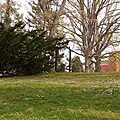 |
November 1, 1996 (#96001241) |
5906 Dalecarlia Pl., NW 38°56′16″N 77°06′56″W / 38.937778°N 77.115556°W | Palisades | |
| 73 | Northwest No. 5 Boundary Marker of the Original District of Columbia |  |
November 1, 1996 (#96001240) |
Dalecarlia Reservoir, 600 ft. W of Dalecarlia Parkway and 300 ft SE of concrete culvert 38°56′41″N 77°06′24″W / 38.944722°N 77.106667°W | Dalecarlia Reservoir | |
| 76 | Northwest No. 8 Boundary Marker of the Original District of Columbia |  |
November 1, 1996 (#96001260) |
6422 Western Ave. 38°58′32″N 77°04′03″W / 38.975556°N 77.0675°W | Barnaby Woods | |
| 77 | Northwest No. 9 Boundary Marker of the Original District of Columbia |  |
November 1, 1996 (#96001259) |
Rock Creek Park, approximately 165 ft. NW of the centerline of Daniel Rd. and 5 ft. SE from edge of 2701 Daniel Rd. 38°59′08″N 77°03′16″W / 38.985556°N 77.054444°W | Rock Creek Park | |
| 88 | Potomac Palisades Site |  |
April 15, 1982 (#82001714) |
Above the Potomac at the junction of MacArthur Boulevard and Foxhall Rd. 38°54′21″N 77°04′52″W / 38.9058°N 77.0811°W | NW |
b |
| 93 | Theodore Roosevelt Island National Memorial |  |
October 15, 1966 (#66000869) |
S of Key Bridge in the Potomac River 38°53′44″N 77°03′44″W / 38.895556°N 77.062222°W | NW | |
| 94 | Rosedale |  |
May 8, 1973 (#73002115) |
3501 Newark St., NW. 38°56′08″N 77°04′07″W / 38.935556°N 77.068611°W | Cleveland Park | |
| 95 | Scheele-Brown House |  |
June 19, 2017 (#100001213) |
2207 Foxhall Rd. NW 38°55′10″N 77°05′19″W / 38.919423°N 77.088737°W | ||
| 96 | Sears, Roebuck and Company Department Store |  |
February 16, 1996 (#96000061) |
4500 Wisconsin Ave., NW 38°56′54″N 77°04′50″W / 38.948333°N 77.080556°W | Tenleytown | |
| 98 | William L. Slayton House |  |
October 2, 2008 (#08000956) |
3411 Ordway St. 38°56′19″N 77°04′03″W / 38.938611°N 77.0675°W | Cleveland Park | International style house, one of only three houses designed by I.M. Pei |
| 99 | Springland |  |
August 9, 1990 (#90001114) |
3550 Tilden St. NW. 38°56′28″N 77°04′13″W / 38.941111°N 77.070278°W | Cleveland Park | |
| 103 | Traveling Carousel | 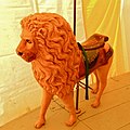 |
September 11, 1997 (#97001116) |
Jct. of Massachusetts and Wisconsin Aves. NW 38°55′43″N 77°04′15″W / 38.928611°N 77.070833°W | Cathedral Heights | Assembled and operated once a year at the All Hallows Guild spring Flower Mart on the south lawn of the National Cathedral. |
| 105 | Twin Oaks |  |
February 5, 1986 (#86000153) |
3225 Woodley Rd. 38°55′54″N 77°03′50″W / 38.931667°N 77.063889°W | NW | |
| 106 | Van Ness Mausoleum |  |
December 17, 1982 (#82001032) |
Oak Hill Cemetery, 3001 R St. NW 38°54′43″N 77°03′19″W / 38.911944°N 77.055139°W | Georgetown | |
| 110 | Washington Aqueduct | September 8, 1973 (#73002123) |
5900 MacArthur Blvd., NW 38°56′09″N 77°06′43″W / 38.935819°N 77.111847°W | Palisades | ||
| 112 | George Washington Memorial Parkway |  |
June 2, 1995 (#95000605) |
Roughly, south side of the Potomac River from American Legion to Memorial Bridge and north side from Brickyard Rd. to Chain Bridge 38°56′00″N 77°06′49″W / 38.933333°N 77.113611°W | NW | Extends into Arlington County, Virginia |
| 114 | Wetzell-Archbold Farmstead |  |
April 19, 1991 (#91000395) |
4437 Reservoir Rd., NW. 38°54′47″N 77°04′56″W / 38.913056°N 77.082222°W | Foxhall |
| [1] | Name on the Register | Image | Date listed[2] | Location | Neighborhood | Description |
|---|---|---|---|---|---|---|
| 1 | Adams Memorial |  |
March 16, 1972 (#72001420) |
Webster St. and Rock Creek Church Rd., NW. 38°56′50″N 77°00′39″W / 38.947222°N 77.010833°W | Petworth | |
| 10 | Army Medical Museum |  |
October 15, 1966 (#66000854) |
Armed Forces Institute of Pathology Building, Walter Reed Army Medical Center, 13th St. and Fern Pl. 38°58′41″N 77°01′47″W / 38.977997°N 77.029667°W | Walter Reed Army Medical Center | Original listed building has been demolished; collection is now in Maryland. |
| 25 | Lucinda Cady House |  |
May 28, 1975 (#75002047) |
7064 Eastern Ave., NW. 38°58′40″N 77°01′07″W / 38.977778°N 77.018611°W | Takoma | |
| 53 | Fire Department Headquarters-Fire Alarm Headquarters |  |
May 18, 2011 (#11000286) |
300 McMillan Dr., NW. 38°55′24″N 77°00′47″W / 38.923333°N 77.013056°W | Bloomingdale | |
| 62 | Garden Club of America Entrance Marker at Georgia Avenue |  |
April 29, 2008 (#08000347) |
Georgia Ave. at Kalmia Rd. & Alaska Ave. 38°59′02″N 77°01′36″W / 38.983808°N 77.026578°W | Shepherd Park | |
| 80 | Holt House |  |
April 24, 1973 (#73002090) |
Adams Mill Rd. in the National Zoological Park 38°55′31″N 77°02′50″W / 38.925278°N 77.047222°W | Rock Creek Park | |
| 123 | Northeast No. 2 Boundary Marker of the Original District of Columbia |  |
November 1, 1996 (#96001257) |
6980 Maple Ave., NW 38°58′32″N 77°00′53″W / 38.975556°N 77.014722°W | NW | |
| 138 | Pierce-Klingle Mansion |  |
October 10, 1973 (#73000223) |
3545 Williamsburg Lane, NW 38°56′18″N 77°03′00″W / 38.938333°N 77.05°W | Cleveland Park | |
| 165 | Takoma Park Historic District |  |
June 30, 1983 (#83001416) |
Roughly bounded by DC/MD boundary, 7th, Piney Branch, Aspen, and Fern Sts. 38°58′31″N 77°01′11″W / 38.975278°N 77.019722°W | Takoma | |
| 186 | Twin Oaks Playground and Field House | February 3, 2020 (#100004941) |
4025 14th St. NW 38°56′26″N 77°01′56″W / 38.9406°N 77.0322°W | |||
| 177 | Van View |  |
December 29, 2014 (#14001083) |
7714 13th St., NW. 38°59′02″N 77°01′48″W / 38.984°N 77.03°W | Shepherd Park | |
| 192 | Wardman Flats |  |
October 10, 2019 (#100004500) |
Square 519 bounded by 3rd, 4th& R Sts., & Florida Ave. NW 38°54′47″N 77°00′57″W / 38.9131°N 77.0157°W | ||
| 182 | Washington Heights Historic District |  |
September 27, 2006 (#06000875) |
Bounded by Columbia Rd., NW, 19th St. NW, 18th St. NW and Florida Ave. NW 38°56′47″N 77°02′22″W / 38.946389°N 77.039444°W | Adams Morgan | |
| 186 | Marjorie Webster Junior College Historic District |  |
February 24, 2014 (#14000015) |
1638 & 1640 Kalmia Rd., NW., 7753 & 7775 17th St., NW. 38°59′08″N 77°02′19″W / 38.985647°N 77.038512°W | Colonial Village |
| [1] | Name on the Register | Image | Date listed[2] | Location | City or town | Description |
|---|---|---|---|---|---|---|
| 4 | Brookland Bowling Alleys |  |
August 19, 2019 (#100004306) |
3726 10th St. NE. 38°56′10″N 76°59′36″W / 38.9362°N 76.9933°W | Brookland | |
| 14 | East Corner Boundary Marker of the Original District of Columbia |  |
November 1, 1996 (#96001249) |
100 ft. E of jct. of Eastern and Southern Aves. 38°53′35″N 76°54′34″W / 38.893056°N 76.909444°W | NE and SE | See List of Boundary Markers of the Original District of Columbia |
| 26 | Kenilworth Aquatic Gardens | 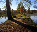 |
August 25, 1978 (#78000258) |
Kenilworth Ave. and Douglas St. NE 38°54′46″N 76°56′37″W / 38.912778°N 76.943611°W | NE | |
| 28 | Kingman Park Historic District |  |
December 17, 2018 (#100002960) |
Between Rosedale & D St., Maryland Ave. NE, 19th St. & Oklahoma Ave. NE 38°53′44″N 76°58′28″W / 38.8956°N 76.974494°W | Kingman Park | |
| 33 | Northeast No. 3 Boundary Marker of the Original District of Columbia | 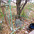 |
November 1, 1996 (#96001256) |
144 ft. NW of jct. of Eastern Ave. and Chillum Rd. 38°57′55″N 77°00′06″W / 38.965271°N 77.001750°W | NE | |
| 34 | Northeast No. 4 Boundary Marker of the Original District of Columbia |  |
November 1, 1996 (#96001255) |
5400 Sargent Rd. 38°57′17″N 76°59′17″W / 38.954722°N 76.988056°W | NE | |
| 35 | Northeast No. 5 Boundary Marker of the Original District of Columbia |  |
November 1, 1996 (#96001254) |
4609 Eastern Ave. 38°56′39″N 76°58′28″W / 38.944167°N 76.974444°W | NE | |
| 36 | Northeast No. 6 Boundary Marker of the Original District of Columbia | 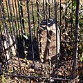 |
November 1, 1996 (#96001253) |
3601 Eastern Ave. 38°56′01″N 76°57′41″W / 38.933611°N 76.961389°W | NE | |
| 37 | Northeast No. 7 Boundary Marker of the Original District of Columbia |  |
November 1, 1996 (#96001252) |
Ft. Lincoln Cemetery 38°55′26″N 76°56′56″W / 38.923889°N 76.948889°W | NE | |
| 38 | Northeast No. 8 Boundary Marker of the Original District of Columbia | 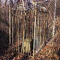 |
November 1, 1996 (#96001251) |
Kenilworth Aquatics Gardens, NW of jct. of Eastern and Kenilworth Aves. 38°54′50″N 76°56′10″W / 38.913889°N 76.936111°W | NE | |
| 39 | Northeast No. 9 Boundary Marker of the Original District of Columbia |  |
November 1, 1996 (#96001250) |
919 Eastern Ave. 38°54′12″N 76°55′21″W / 38.903333°N 76.9225°W | NE | |
| 49 | U.S. National Arboretum |  |
April 11, 1973 (#73002122) |
24th and R Sts., NE. 38°54′42″N 76°57′58″W / 38.911667°N 76.966111°W | NE | |
| 54 | United Brick Corporation Brick Complex |  |
October 3, 1978 (#78003061) |
2801 New York Ave., NE. 38°54′58″N 76°58′06″W / 38.916111°N 76.968333°W | NE |
| [1] | Name on the Register | Image | Date listed[2] | Location | Quadrant | Description |
|---|---|---|---|---|---|---|
| 6 | Commandant's Office, Washington Navy Yard |  |
August 14, 1973 (#73002077) |
Montgomery Sq. and Dahlgren Ave., SE. 38°52′23″N 76°59′43″W / 38.873056°N 76.995278°W | SE | See Washington Navy Yard |
| 8 | Frederick Douglass National Historic Site |  |
October 15, 1966 (#66000033) |
1411 W St., SE. 38°51′45″N 76°59′04″W / 38.8625°N 76.984444°W | SE | |
| 10 | East Corner Boundary Marker of the Original District of Columbia |  |
November 1, 1996 (#96001249) |
100 feet east of the junction of Eastern and Southern Aves. 38°53′35″N 76°54′34″W / 38.893056°N 76.909444°W | NE and SE | See List of Boundary Markers of the Original District of Columbia |
| 21 | Quarters B, Washington Navy Yard |  |
August 14, 1973 (#73002112) |
Charles Morris Ave., SE. 38°52′32″N 76°59′39″W / 38.875556°N 76.994167°W | SE | |
| 26 | Southeast No. 1 Boundary Marker of the Original District of Columbia |  |
November 1, 1996 (#96001248) |
30 feet south of the junction of Southern Ave. and D St., SE 38°52′58″N 76°55′20″W / 38.882786°N 76.922303°W | SE | |
| 27 | Southeast No. 2 Boundary Marker of the Original District of Columbia |  |
November 1, 1996 (#96001247) |
4345 Southern Ave. 38°52′20″N 76°56′09″W / 38.872222°N 76.935833°W | SE | |
| 28 | Southeast No. 3 Boundary Marker of the Original District of Columbia |  |
November 1, 1996 (#96001246) |
3908 Southern Ave. 38°51′43″N 76°56′55″W / 38.861944°N 76.948611°W | SE | |
| 29 | Southeast No. 5 Boundary Marker of the Original District of Columbia |  |
November 1, 1996 (#96001245) |
280 feet northeast of the junction of Southern Ave. and Valley Terrace 38°50′31″N 76°58′29″W / 38.841944°N 76.974722°W | SE | |
| 30 | Southeast No. 6 Boundary Marker of the Original District of Columbia |  |
November 1, 1996 (#96001244) |
901 Southern Ave. 38°49′54″N 76°59′17″W / 38.831667°N 76.988056°W | SE | |
| 31 | Southeast No. 7 Boundary Marker of the Original District of Columbia |  |
November 1, 1996 (#96001243) |
25 feet northeast of the junction of Southern Ave. and Indian Head Rd. 38°49′17″N 77°00′05″W / 38.821389°N 77.001389°W | SE |
- ^ a b c d e Numbers represent an alphabetical ordering by significant words. Various colorings, defined here, differentiate National Historic Landmarks and historic districts from other NRHP buildings, structures, sites or objects.
- ^ a b c d e The eight-digit number below each date is the number assigned to each location in the National Register Information System database, which can be viewed by clicking the number.

