User:Mhatopzz/Mount Binaiya
Appearance
| Mount Binaiya | |
|---|---|
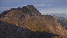
 Mount Binaiya at Manusela NP | |
| Highest point | |
| Elevation | 3,027 m (9,931 ft)[1] |
| Prominence | 3,027 m (9,931 ft)[2] Ranked 88th |
| Listing | Island high point Ultra Ribu |
| Coordinates | 3°10′24″S 129°27′18″E / 3.17333°S 129.45500°E[2] |
| Geography | |
| Location | Seram, Maluku Province, Indonesia |
Mount Binaiya (Indonesian: Gunung Binaia) is the highest point on the Indonesian island of Seram (or Ceram) and the highest mountain in the province of Maluku. With an elevation of 3,027 metres (9,931 ft), it is one of the one hundred most topographically prominent peaks on Earth.
Geology
[edit]Conservation
[edit]The mountain is located at the Manusela National Park
Manusela National Park
[edit]References
[edit]- ^ "Gunung Binaiya, Indonesia" Peakbagger.com. Retrieved 2011-11-23.
- ^ a b Indonesian high-prominence peaks on peaklist.org

