User:Iune/2002
| Iune/2002 | |
|---|---|
 Season summary map | |
| Seasonal boundaries | |
| First system formed | January 12, 2002 |
| Last system dissipated | December 11, 2002 |
| Strongest storm | |
| Name | Fengshen |
| • Maximum winds | 185 km/h (115 mph) (10-minute sustained) |
| • Lowest pressure | 920 hPa (mbar) |
| Seasonal statistics | |
| Total storms | 26 official, 2 unofficial |
| Typhoons | 15 |
| Super typhoons | 8 (unofficial) |
| Total fatalities | 310 |
| Total damage | $7.4 billion (2002 USD) |
The 2002 Pacific typhoon season had no official bounds; it ran year-round in 2002, but most tropical cyclones tend to form in the northwestern Pacific Ocean between May and November.[1] These dates conventionally delimit the period of each year when most tropical cyclones form in the northwestern Pacific Ocean.
The scope of this article is limited to the Pacific Ocean, north of the equator and west of the International Date Line. Storms that form east of the date line and north of the equator are called hurricanes; see 2002 Pacific hurricane season. Tropical Storms formed in the entire west Pacific basin are assigned a name by the Tokyo Typhoon Center. Tropical depressions in this basin have the "W" suffix added to their number. Tropical depressions that enter or form in the Philippine area of responsibility are assigned a name by the Philippine Atmospheric, Geophysical and Astronomical Services Administration or PAGASA. This can often result in the same storm having two names.
Storms
[edit]In storm information below, wind-speed advisories differ from the Joint Typhoon Warning Center (JTWC) to the JMA as the JTWC uses the United States criteria of 1-minute mean to designate maximum sustained winds, while the JMA uses the 10-minute mean wind criteria to designate tropical cyclone maximum sustained winds. This difference generally results in JTWC maximum winds appearing higher than the maximum winds described by the JMA for the same cyclone. Most of the 31 cyclones that developed this year either remained out at sea or were weak at landfall.
Tropical Storm Tapah (Agaton)
[edit]| Tropical storm (JMA) | |
| Tropical storm (SSHWS) | |
| Duration | January 12 – January 13 |
|---|---|
| Peak intensity | 75 km/h (45 mph) (10-min); 996 hPa (mbar) |
Typhoon Mitag (Basyang)
[edit]| Very strong typhoon (JMA) | |
| Category 5 super typhoon (SSHWS) | |
| Duration | February 28 – March 8 |
|---|---|
| Peak intensity | 175 km/h (110 mph) (10-min); 930 hPa (mbar) |
In Micronesia, one person was killed and caused $150 million in damages[3]
Tropical Depression 03W (Caloy)
[edit]| Tropical depression (PAGASA) | |
| Tropical depression (SSHWS) | |
| Duration | March 18 – March 25 |
|---|---|
| Peak intensity | 55 km/h (35 mph) (10-min); 1000 hPa (mbar) |
When Tropical Depression 03W crossed the southern and central Philippines on March 21 and 22nd, it caused 35 casualties and $1.7 million in damage.
Tropical Depression 04W
[edit]| Tropical depression (SSHWS) | |
| Duration | April 5 – April 6 |
|---|---|
| Peak intensity | 55 km/h (35 mph) (1-min); 1000 hPa (mbar) |
Typhoon Hagibis
[edit]| Very strong typhoon (JMA) | |
| Category 5 super typhoon (SSHWS) | |
| Duration | May 16 – May 21 |
|---|---|
| Peak intensity | 175 km/h (110 mph) (10-min); 935 hPa (mbar) |
Tropical Depression 06W (Dagul)
[edit]| Tropical depression (PAGASA) | |
| Tropical depression (SSHWS) | |
| Duration | May 27 – May 30 |
|---|---|
| Peak intensity | 55 km/h (35 mph) (10-min); 1002 hPa (mbar) |
Severe Tropical Storm Noguri (Espada)
[edit]| Severe tropical storm (JMA) | |
| Category 2 typhoon (SSHWS) | |
| Duration | June 8 – June 10 |
|---|---|
| Peak intensity | 110 km/h (70 mph) (10-min); 975 hPa (mbar) |
Typhoon Rammasun (Florita)
[edit]| Very strong typhoon (JMA) | |
| Category 3 typhoon (SSHWS) | |
| Duration | June 29 – July 6 |
|---|---|
| Peak intensity | 155 km/h (100 mph) (10-min); 945 hPa (mbar) |
Typhoon Chataan (Gloria)
[edit]| Very strong typhoon (JMA) | |
| Category 4 super typhoon (SSHWS) | |
| Duration | June 29 – July 11 |
|---|---|
| Peak intensity | 175 km/h (110 mph) (10-min); 930 hPa (mbar) |
Chataan killed 55 and $59.8 million in damage between Chuuk and Guam, making it the first typhoon to hit the area since Typhoon Paka in 1997.
Typhoon Halong (Inday)
[edit]| Very strong typhoon (JMA) | |
| Category 4 super typhoon (SSHWS) | |
| Duration | July 7 – July 16 |
|---|---|
| Peak intensity | 155 km/h (100 mph) (10-min); 945 hPa (mbar) |
Severe Tropical Storm Nakri (Hambalos)
[edit]| Severe tropical storm (JMA) | |
| Tropical storm (SSHWS) | |
| Duration | July 9 – July 12 |
|---|---|
| Peak intensity | 95 km/h (60 mph) (10-min); 983 hPa (mbar) |
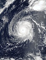
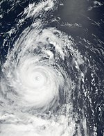
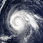
Typhoon Fengshen
[edit]| Very strong typhoon (JMA) | |
| Category 5 super typhoon (SSHWS) | |
| Duration | July 14 – July 27 |
|---|---|
| Peak intensity | 185 km/h (115 mph) (10-min); 920 hPa (mbar) |
Tropical Storm 13W (Juan)
[edit]| Tropical depression (PAGASA) | |
| Tropical storm (SSHWS) | |
| Duration | July 17 – July 23 |
|---|---|
| Peak intensity | 55 km/h (35 mph) (10-min); 997 hPa (mbar) |
Damage in the Philippines was estimated at $25 Million with Juan causing 18 Deaths.
Tropical Storm Kalmaegi
[edit]| Tropical storm (JMA) | |
| Tropical depression (SSHWS) | |
| Duration | July 20 – July 21 |
|---|---|
| Peak intensity | 65 km/h (40 mph) (10-min); 1002 hPa (mbar) |
Typhoon Fung-wong (Kaka)
[edit]| Typhoon (JMA) | |
| Category 1 typhoon (SSHWS) | |
| Duration | July 20 – July 27 |
|---|---|
| Peak intensity | 130 km/h (80 mph) (10-min); 960 hPa (mbar) |
Severe Tropical Storm Kammuri (Lagalag)
[edit]| Severe tropical storm (JMA) | |
| Tropical storm (SSHWS) | |
| Duration | August 3 – August 5 |
|---|---|
| Peak intensity | 100 km/h (65 mph) (10-min); 980 hPa (mbar) |
107 people died because of Kammuri and the direct economic losses are estimated at 4.219 billion yuan. The reported number of collapsed houses was 20,182.[4]
Tropical Depression 17W
[edit]| Tropical depression (SSHWS) | |
| Duration | August 5 – August 6 |
|---|---|
| Peak intensity | 45 km/h (30 mph) (1-min); 999 hPa (mbar) |
Tropical Storm 18W (Milenyo)
[edit]| Tropical depression (PAGASA) | |
| Tropical storm (SSHWS) | |
| Duration | August 10 – August 14 |
|---|---|
| Peak intensity | 55 km/h (35 mph) (10-min); 997 hPa (mbar) |
Typhoon Phanfone
[edit]| Very strong typhoon (JMA) | |
| Category 4 super typhoon (SSHWS) | |
| Duration | August 12 – August 21 |
|---|---|
| Peak intensity | 155 km/h (100 mph) (10-min); 940 hPa (mbar) |
Tropical Storm Vongfong (Milenyo)
[edit]| Tropical storm (JMA) | |
| Tropical storm (SSHWS) | |
| Duration | August 18 – August 19 |
|---|---|
| Peak intensity | 75 km/h (45 mph) (10-min); 985 hPa (mbar) |
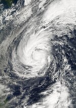
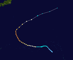
Typhoon Rusa
[edit]| Typhoon (JMA) | |
| Category 4 typhoon (SSHWS) | |
| Duration | August 23 – September 1 |
|---|---|
| Peak intensity | 150 km/h (90 mph) (10-min); 950 hPa (mbar) |
When 80 mph (130 km/h) Typhoon Rusa, which peaked at 135 mph (217 km/h) winds earlier in its lifetime, hit South Korea, it caused torrential flooding, causing 113 casualties (with 71 missing) and nearly $6 billion in damage (2002 USD).
Typhoon Sinlaku
[edit]| Typhoon (JMA) | |
| Category 3 typhoon (SSHWS) | |
| Duration | August 29 – September 8 |
|---|---|
| Peak intensity | 150 km/h (90 mph) (10-min); 950 hPa (mbar) |
Typhoon Ele
[edit]| Very strong typhoon (JMA) | |
| Category 4 typhoon (SSHWS) | |
| Duration | August 30 – September 9 |
|---|---|
| Peak intensity | 165 km/h (105 mph) (10-min); 940 hPa (mbar) |
Tropical Storm Hagupit
[edit]| Tropical storm (JMA) | |
| Tropical storm (SSHWS) | |
| Duration | September 10 – September 12 |
|---|---|
| Peak intensity | 85 km/h (50 mph) (10-min); 990 hPa (mbar) |
Tropical Storm Changmi
[edit]| Tropical storm (JMA) | |
| Duration | September 21 – September 23 |
|---|---|
| Peak intensity | 85 km/h (50 mph) (10-min); 985 hPa (mbar) |
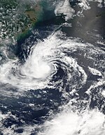
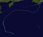
On the afternoon of September 15, the JTWC noted that an area of thunderstorms had developed about 155 miles (255 km) north-northeast of Chuuk.[5] Satellite imagery showed weak pulsing thunderstorm activity associated with a possible low-level circulation center (LLC).[5] In addition, vertical wind shear was noted as moderate.[5] On September 17, the LLC was relocated to 380 miles (610 km) east-northeast of Guam. Pulsing deep convection was noted with a LLC that was embedded in the monsoon trough.[5] The next afternoon, the JTWC issued a Tropical Cyclone Formation Alert (TCFA) as the system as deep convection had increased.[5]
At the same time, the JMA began monitoring the system as a tropical depression.[5] However, they placed the LLC 115 miles (185 km) southwest of the JTWC position.[5] As the storm moved northward, the JTWC center became fully-exposed and the JMA center became the dominant LLC.[5] Subsequently, the JTWC canceled the TCFA during the morning of September 19 as the two circulation centers were merging.[5] The same afternoon, the JMA also downgraded the depression into an area of low pressure.[5]
The weak low pressure area continued to move northwards as the JTWC noted on September 21 that multiple exposed circulation centers were located south of an area of deep thunderstorm activity.[5] Later that morning, the JTWC issued another TCFA as deep convection was increasing in association with a LLC 290 miles (465 km) northwest of Iwo Jima.[5] At the same time, the JMA re-upgraded the low pressure area into a weak tropical depression.[5] However, the vertical wind shear was noted as increasing as the storm was interacting with the mid-latitude flow.[5]
Despite this, the JMA abruptly upgraded the depression to a 45 mph (70 km/h) tropical storm and gave it the name "Changmi" early on September 22.[5] Despite the upgrade, the JTWC again canceled the TCFA as extensive dry entrainment was indicative of a developing extratropical cyclone.[5] The JMA however reported that Changmi had reached its peak intensity while tropical of 50 mph (80 km/h).[5]
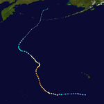
Early on September 23, the JMA reported that Changmi had become extratropical while 345 miles (555 km) east of Tokyo.[5] The extratropical cyclone continued to move northwestward, eventually gaining hurricane-force winds. The last bulletin on the cyclone was issued on September 25 with the cyclone having winds of 75 mph (120 km/h) and a minimum pressure of 958 mbar (hPa) while located in the Bering Sea.[5]
Tropical Storm Mekkhala
[edit]| Tropical storm (JMA) | |
| Tropical storm (SSHWS) | |
| Duration | September 25 – September 28 |
|---|---|
| Peak intensity | 85 km/h (50 mph) (10-min); 990 hPa (mbar) |
Typhoon Higos
[edit]| Very strong typhoon (JMA) | |
| Category 4 super typhoon (SSHWS) | |
| Duration | September 26 – October 2 |
|---|---|
| Peak intensity | 175 km/h (110 mph) (10-min); 930 hPa (mbar) |
9 deaths and widespread flooding can be attributed to Higos.
Typhoon Bavi
[edit]| Typhoon (JMA) | |
| Category 1 typhoon (SSHWS) | |
| Duration | October 9 – October 13 |
|---|---|
| Peak intensity | 120 km/h (75 mph) (10-min); 970 hPa (mbar) |
Tropical Depression 27W
[edit]| Tropical depression (SSHWS) | |
| Duration | October 16 – October 20 |
|---|---|
| Peak intensity | 55 km/h (35 mph) (1-min); 1000 hPa (mbar) |
Tropical Depression 28W
[edit]| Tropical depression (SSHWS) | |
| Duration | October 17 – October 19 |
|---|---|
| Peak intensity | 55 km/h (35 mph) (1-min); 1000 hPa (mbar) |
Severe Tropical Storm Maysak
[edit]| Severe tropical storm (JMA) | |
| Category 1 typhoon (SSHWS) | |
| Duration | October 27 – October 30 |
|---|---|
| Peak intensity | 100 km/h (65 mph) (10-min); 980 hPa (mbar) |
Typhoon Huko
[edit]| Typhoon (JMA) | |
| Category 1 typhoon (SSHWS) | |
| Duration | November 3 – November 7 |
|---|---|
| Peak intensity | 140 km/h (85 mph) (10-min); 985 hPa (mbar) |
Typhoon Haishen
[edit]| Very strong typhoon (JMA) | |
| Category 2 typhoon (SSHWS) | |
| Duration | November 20 – November 25 |
|---|---|
| Peak intensity | 165 km/h (105 mph) (10-min); 955 hPa (mbar) |
Typhoon Pongsona
[edit]| Very strong typhoon (JMA) | |
| Category 4 super typhoon (SSHWS) | |
| Duration | December 3 – December 11 |
|---|---|
| Peak intensity | 165 km/h (105 mph) (10-min); 940 hPa (mbar) |
Typhoon Pongsona was the last typhoon of the season, and was the costliest disaster in 2002 in the United States.[6]
Considered by some to be the worst typhoon to have struck Guam, Pongsona produced strong wind gusts peaking at 278 km/h (173 mph), which left the entire island without power and destroyed about 1,300 houses. With strong building standards and experience from repeated typhoon strikes, there were no fatalities directly related to Pongsona, though there was one indirect death from flying glass. Damage on the island totaled over $700 million (2002 USD, $800 million 2007 USD), making Pongsona among the five costliest typhoons on the island. The typhoon also caused heavy damage on Rota and elsewhere in the Northern Marianas Islands, and as a result of its impact, the name was retired.
Storm names
[edit]International names
[edit]Western North Pacific tropical cyclones are named by the RSMC Tokyo-Typhoon Center of the Japan Meteorological Agency. Names are selected from the following sequential list, there is no annual list. Names were contributed by 13 members of the ESCAP/WMO Typhoon Committee, except for Singapore. The 13 nations or territories, along with Micronesia, each submitted 10 names, which are used in alphabetical order by the English name of the country. The first storm of 2002 was named Tapah and the final one was named Pongsona.
In addition to the 26 storms named by the JMA, Hurricanes Ele and Huko moved into the Western Pacific from the Central Pacific; keeping their names and gaining the designations 0217 and 0224.
|
|
|
|
The Philippine Atmospheric, Geophysical and Astronomical Services Administration (PAGASA) uses its own naming scheme for tropical cyclones within its area of responsibility. Lists are recycled every four years.
|
|
|
|
|
Retirement
[edit]The names Chataan, Rusa, and Pongsona were retired after this year. They were replaced with Matmo, Nuri, and Noul.
See also
[edit]- List of Pacific typhoon seasons
- 2002 Pacific hurricane season
- 2002 Atlantic hurricane season
- 2002 North Indian Ocean cyclone season
- South-West Indian Ocean cyclone seasons: 2001-02, 2002-03
- Australian region cyclone seasons: 2001-02, 2002-03
- South Pacific cyclone seasons: 2001-02, 2002-03
References
[edit]- ^ http://www.typhoon2000.ph/garyp_mgtcs/may03sum.txt
- ^ Padgett, Gary. "Monthly Global Tropical Cyclone Summary January 2002". Typhoon2000. Retrieved 16 July 2010.
- ^ http://www4.ncdc.noaa.gov/cgi-win/wwcgi.dll?wwevent~ShowEvent~484777
- ^ [1][dead link]
- ^ a b c d e f g h i j k l m n o p q r s Padgett, Gary. "Monthly Global Tropical Cyclone Summaryy September 2002". Typhoon 2000. Retrieved 17 July 2010.
- ^ Federal Emergency Management Agency (2003). "Super Typhoon Pongsona: The First 100 Days Over $300 Million In Disaster Relief And Assistance". Retrieved 2007-07-27.
External links
[edit]- Japan Meteorological Agency
- China Meteorological Agency
- National Weather Service Guam
- Hong Kong Observatory
- Macau Meteorological Geophysical Services
- Korea Meteorological Agency
- Philippine Atmospheric, Geophysical and Astronomical Services Administration
- Taiwan Central Weather Bureau
- Joint Typhoon Warning Center
- Digital Typhoon - Typhoon Images and Information
- Typhoon2000 Philippine typhoon website


