User:Festucalex/Draft:Hamad City
Appearance
Hamad City
مدينة حمد Madīnat Ḥamad | |
|---|---|
Neighborhood | |
| Coordinates: 31°22′35″N 34°19′7″E / 31.37639°N 34.31861°E | |
| Territory | Gaza Strip |
| City | Khan Younis |
| Named for | Hamad bin Khalifa Al Thani |
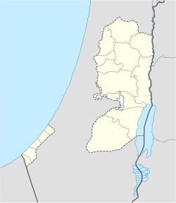
Hamad City (Arabic: مدينة حمد, romanized: Madīnat Ḥamad) is a residential neighborhood in the city of Khan Younis in the Gaza Strip, built on the former location of the Israeli settlement of Katif. It was built using Qatari financial aid following the devastation of the 2012 Gaza War, and thus is named after Qatar's former Emir Hamad bin Khalifa Al Thani.
Info gathered
[edit]- ar:مدينة حمد السكنية (غزة)
- BBC: Qatar Gulf row threatens cash crisis for Gaza
- The Peninsula: Payment exemptions for residents of Hamad City for 2020
- MOFA Qatar: Qatari Committee Delivers Residential Units of Second Phase of HH Sheikh Hamad bin Khalifa City in Gaza Strip
- DW: Qatar, Hamas and the new Middle East
- Roya News: Two killed in Israeli Occupation attack on residential apartment in Gaza
- International Journal of Housing Markets and Analysis: Post-conflict housing reconstruction in the Gaza Strip: A case study of agency-driven housing in Sheikh Hamad city
- Gulf Times: Payment exemption for residents of Hamad City in Gaza for 2020
- MEMO: Qatar completes first phase of Sheikh Hamad city in Gaza
- Qatar Tribune: Qatar hands over 2nd phase of HH Sheikh Hamad City in Gaza
- العربي الجديد: غزة.. شقق مدينة حمد حققت أحلام هؤلاء
- الأناضول: قطر تسلم شقق "المرحلة الأولى" من مدينة "حمد السكنية" في غزة
- الرأي: أمير قطر يزور غزة ويضع حجر الأساس لمدينة حمد السكنية في خان يونس
- الرأي الفلسطيني: تسليم شقق المرحلة الأولى من "مدينة حمد"
- الوطن: "الوطن" تكشف حقيقة مشروع "خيري" قطري في غزة
- الراية: بدء إنشاء مدينة حمد في غزة قريباً
- الأخبار: «مدينة حمد» في غزة: مزاد علني على الفقراء!
- الشرق: مدينة حمد.. مساكن لفقراء غزة على نمط العمارة الأوروبية
- الخليج أونلاين: مدينة حمد.. أكبر مشروع للإيواء بغزة وتوفير آلاف فرص العمل

