User:Abyssal/Portal:Neogene
The Neogene Portal IntroductionSelected article on the Neogene world and its legacies The earliest organisms that can be classified as fish were soft-bodied chordates that first appeared during the Cambrian period. Although they lacked a true spine, they possessednotochords which allowed them to be more agile than their invertebrate counterparts. Fish would continue to evolve through the Paleozoic era, diversifying into a wide variety of forms. Many fish of the Paleozoic developed external armor that protected them from predators. The first fish with jaws appeared in the Silurian period, after which many (such as sharks) became formidable marine predators rather than just the prey of arthropods. (see more...) Did you know?
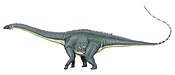
Need help?Do you have a question about Abyssal/Portal:Neogene that you can't find the answer to? Consider asking it at the Wikipedia reference desk. Selected image
Selected article on the Neogene in human science, culture and economics The Bone Wars is the name given to a period of intense fossil speculation and discovery during the Gilded Age of American history, marked by a heated rivalry between Edward Drinker Cope and Othniel Charles Marsh. The two paleontologists used underhanded methods to out-compete the other in the field, resorting to bribery, theft, and destruction of bones. The scientists also attacked each other in scientific publications, attempting to ruin the other's credibility and cut off his funding. Originally colleagues who were civil to each other, Cope and Marsh became bitter enemies after several personal slights between them. Their pursuit of bones led them west to rich bone beds in Colorado, Nebraska, and Wyoming. From 1877 to 1892, both paleontologists used their wealth and influence to finance their own expeditions and to procure services and fossils from dinosaur hunters. By the end of the Bone Wars, both men exhausted their funds in fueling their intense rivalry. Cope and Marsh were financially and socially ruined by their efforts to disgrace each other, but their contributions to science and the field of paleontology were massive; the scientists left behind tons of unopened boxes of fossils on their deaths. The feud between the two men led to over 142 new species of dinosaurs being discovered and described. Several historical books and fictional adaptations have also been published about this period of intense paleontological activity. (see more...) TopicsGeochronology - Neogene (Miocene - Pliocene) Neogene landmasses - Major Neogene events - Neogene biota appearances - Fossil sites - Stratigraphic units - History - History of paleontology - Timeline of paleontology Researchers - Culture - Treatise on Invertebrate Paleontology - Vertebrate Paleontology SubcategoriesQuality ContentFeatured Neogene articles - None yet Good Neogene articles - Nonet yet Things you can do
WikiProjects
Related contentAssociated WikimediaThe following Wikimedia Foundation sister projects provide more on this subject:
|