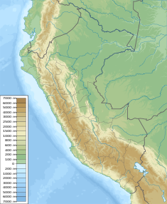
Upamayo Dam
Appearance
| Upamayo Dam | |
|---|---|
| Country | Peru |
| Location | Junín Region, Pasco Region |
| Coordinates | 10°55′22″S 76°16′39″W / 10.92278°S 76.27750°W |
| Status | Operational |
| Opening date | 1936 |
| Dam and spillways | |
| Impounds | Upamayo River |
| Height | 10 m (33 ft) |
| Length | 96 m (315 ft) |
| Reservoir | |
| Total capacity | 556,000,000 m3 (451,000 acre⋅ft) |
The Upamayo Dam[1][2] (possibly from Quechua upa calm, silent; mute, mayu river)[3] is a dam at Lake Junin, the largest lake entirely in Peru. It is located on the border of the Junín Region, Junín Province, Ondores District, and the Pasco Region, Pasco Province, Vicco District.[4][2]
The dam was erected in 1936. It is 10 m (33 ft) high and 96 m (105 yd) long. It is operated by Centromín Perú.[1] The reservoir has a capacity of 556,000,000 m3 (451,000 acre⋅ft).[1]
References
[edit]- ^ a b c Recursos Hídricos del Perú en Cifras, Boletín Técnico de Recursos Hídricos 2010, Autoridad Nacional del Agua, Ministerio de Agricultura, Perú
- ^ a b Obras hidraulicos en la cuenca de Mantaro - fuente : fuente: Electroperu - Inventario proyectos de afianzamiento hidrico Cuenca del Rio Mantaro, 2005
- ^ Teofilo Laime Ajacopa (2007). Diccionario Bilingüe: Iskay simipi yuyayk’anch: Quechua – Castellano / Castellano – Quechua (PDF). La Paz, Bolivia: futatraw.ourproject.org.
- ^ escale.minedu.gob.pe - UGEL map of the Junín Province (Junín Region)

