Toulépleu
Appearance
Toulépleu | |
|---|---|
Town, sub-prefecture, and commune | |
| Coordinates: 6°34′N 8°25′W / 6.567°N 8.417°W | |
| Country | |
| District | Montagnes |
| Region | Cavally |
| Department | Toulépleu |
| Population (2014)[1] | |
• Total | 15,745 |
| Time zone | UTC+0 (GMT) |
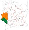
Toulépleu is a town in the far west of Ivory Coast, near the border with Liberia. It is a sub-prefecture and the seat of Toulépleu Department in Cavally Region, Montagnes District. Toulépleu is also a commune.
Notes
[edit]- ^ "Côte d'Ivoire". geohive.com. Retrieved 7 December 2015.


