Terjola Municipality
Appearance
Terjola Municipality
თერჯოლის მუნიციპალიტეტი | |
|---|---|
 Church in Bardubani | |
 Location of the municipality within Georgia | |
| Country | |
| Region | Imereti |
| Capital | Terjola |
| Government | |
| • Type | Mayor–Council |
| • Body | Terjola City Assembly |
| • Mayor | Teimuraz Japaridze (GD) |
| Area | |
• Total | 357 km2 (138 sq mi) |
| Population (2014) | |
• Total | 35,563 |
| • Density | 99.61/km2 (258.0/sq mi) |
| Population by ethnicity[1] | |
| • Georgians | 99,7 % |
| • Russians | 0,2 % |
| • Others | 0,2 % |
| Time zone | UTC+4 (Georgian Standard Time) |
Terjola (Georgian: თერჯოლის მუნიციპალიტეტი) is a district of Georgia, in the region of Imereti. Its main town is Terjola.
Population: 35,563 (2014 census)
Area: 357 km2
Politics
[edit]Terjola Municipal Assembly (Georgian: თერჯოლის საკრებულო, Terjolis Sakrebulo) is a representative body in Terjola Municipality, consisting of 30 members and elected every four years. The last election was held in October 2021.
| Party | 2017[2] | 2021[3] | Current Municipal Assembly | |||||||||||||||||||||||||||||||||||||||||||
|---|---|---|---|---|---|---|---|---|---|---|---|---|---|---|---|---|---|---|---|---|---|---|---|---|---|---|---|---|---|---|---|---|---|---|---|---|---|---|---|---|---|---|---|---|---|---|
| Georgian Dream | 29 | 17 | ||||||||||||||||||||||||||||||||||||||||||||
| United National Movement | 1 | 8 | ||||||||||||||||||||||||||||||||||||||||||||
| European Georgia | 4 | 3 | ||||||||||||||||||||||||||||||||||||||||||||
| For Georgia | 1 | |||||||||||||||||||||||||||||||||||||||||||||
| People's Power | 1[a] | |||||||||||||||||||||||||||||||||||||||||||||
| Alliance of Patriots | 1 | |||||||||||||||||||||||||||||||||||||||||||||
| Total | 35 | 30 | ||||||||||||||||||||||||||||||||||||||||||||
Gallery
[edit]-
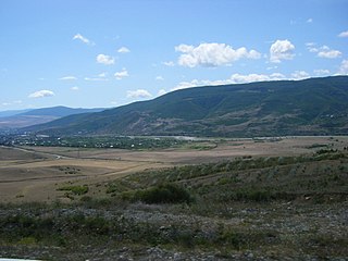
Terjola Countryside
-
Tskaltsitela river
-
Tskaltsitela river
See also
[edit]Explanatory notes
[edit]- ^ Split from Georgian Dream.[4]
References
[edit]- ^ "Ethnic composition of Georgia 2014". mashke.org. Archived from the original on 2018-11-04.
- ^ "Protocol elected municipal council members and mayors 2017" (PDF) (in Georgian). CESKO Central Election Commission. Retrieved 2022-12-18.
- ^ "Protocol elected municipal council members and mayors 2021" (PDF) (in Georgian). CESKO Central Election Commission. Retrieved 2022-12-18.
- ^ ""ქართულ ოცნებას" რეგიონული ჩინოვნიკებიც ტოვებენ და კელი დეგნანს აკრიტიკებენ". jam-news.net (in Georgian). 2022-07-11. Retrieved 2022-12-20.
External links
[edit]- Districts of Georgia, Statoids.com
42°10′41″N 42°58′48″E / 42.17806°N 42.98000°E


