Template:POTD/2024-03-27
Appearance
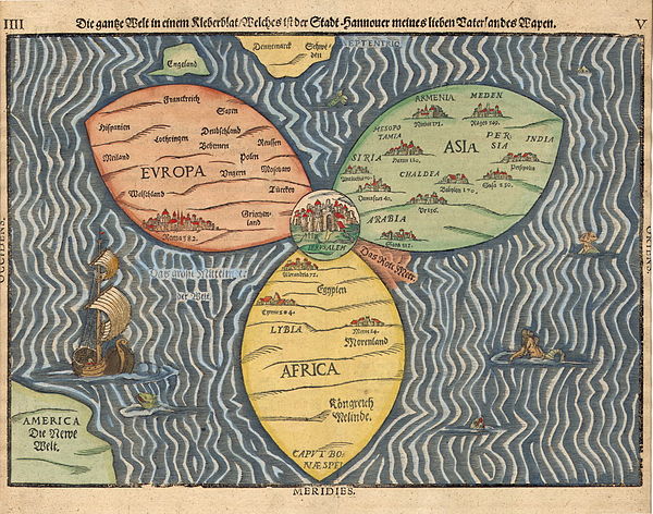
The Bünting cloverleaf map is a historic mappa mundi drawn by the German theologian and cartographer Heinrich Bünting. The map was published in his book Itinerarium Sacrae Scripturae in 1581. The map depicts the three continents of the Old World, Europe, Africa and Asia, as three leaves forming the shape of a clover, with Jerusalem at the centre. The three continents include captions for some of their countries and illustrations of cities. The clover is surrounded by the ocean, with its surface including illustrations of sea creatures, monsters, and a ship. England and Denmark are represented as two island-shapes above Europe's leaf, while the Americas are shown as a mostly unrevealed shape in the lower left corner, captioned Die Neue Welt (the New World).Map credit: Heinrich Bünting

