Jump to content

Template:Infobox bridge/testcases

Coordinates: 39°13′1″N 76°31′42″W / 39.21694°N 76.52833°W / 39.21694; -76.52833
From Wikipedia, the free encyclopedia

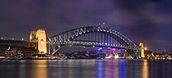
Sydney Harbour Bridge

[edit]
Side by side comparison
{{Infobox bridge}}{{Infobox bridge/sandbox}}
Sydney Harbour Bridge
Coordinates33°51′08″S 151°12′39″E / 33.8522°S 151.2107°E / -33.8522; 151.2107
CarriesTrains, Motor vehicles, pedestrians and bicycles
CrossesPort Jackson
LocaleSydney, New South Wales, Australia
Characteristics
DesignThrough arch bridge
Total length1,149 m (3,770 ft)
Width49 m (161 ft)
Height134 m (440 ft)
Longest span503 m (1,650 ft)
Clearance below49 m (161 ft) at mid-span
History
Construction start28 July 1923
Construction end19 January 1932
Opened19 March 1932 (1932-03-19)
Location
Map

Golden Gate Bridge

[edit]
Side by side comparison
{{Infobox bridge}}{{Infobox bridge/sandbox}}
Infobox bridge/testcases
Coordinates37°49′11″N 122°28′43″W / 37.81972°N 122.47861°W / 37.81972; -122.47861
Carries6 lanes of US 101 / SR 1 (see below), pedestrians and bicycles.
CrossesGolden Gate
LocaleSan Francisco, California and Marin County, California, U.S.
Official nameGolden Gate Bridge
Maintained byGolden Gate Bridge, Highway and Transportation District[1]
Heritage statusCalifornia Historical Landmark Edit this on Wikidata
ID numberCA27 0052 Edit this on Wikidata
Websitewww.goldengate.org/bridge/ Edit this on Wikidata
Next upstreamRichmond–San Rafael Bridge Edit this on Wikidata
Characteristics
DesignArt Deco, Suspension, truss arch & truss causeways
MaterialSteel
Total length8,981 ft (2,737.4 m),[2] about 1.7 mi (2.7 km)
Width90 ft (27.4 m)
Height746 ft (227.4 m)
Longest span4,200 ft (1,280.2 m), about 0.79 miles (1.28 km)
Clearance above14 ft (4.3 m) at toll gates, Trucks cannot pass
Clearance below220 ft (67.1 m) at high tide
History
ArchitectIrving Morrow
Engineering design byJoseph Strauss, and Charles Ellis
OpenedMay 27, 1937; 87 years ago (1937-05-27)
Statistics
Daily traffic110,000[3]
TollCars (southbound only)
$8.00 (Pay by plate), $7.00 (FasTrak), $5.00 (carpools during peak hours, FasTrak only)
DesignatedJune 18, 1987[4]
Reference no.974
DesignatedMay 21, 1999[5]
Reference no.222
Location
Map

Tower Bridge

[edit]
Side by side comparison
{{Infobox bridge}}{{Infobox bridge/sandbox}}
Tower Bridge
Coordinates51°30′20″N 0°04′31″W / 51.50556°N 0.07528°W / 51.50556; -0.07528
OS grid referenceTQ336802
CarriesA100 Tower Bridge Road
CrossesRiver Thames
LocaleLondon boroughs:
– north side: Tower Hamlets
– south side: Southwark
Maintained byBridge House Estates
Heritage statusGrade I listed structure
Websitewww.towerbridge.org.uk Edit this on Wikidata
Preceded byLondon Bridge
Followed byQueen Elizabeth II Bridge
Characteristics
DesignBascule bridge / Suspension Bridge
Total length801 ft (244 m)
Height213 ft (65 m)
Longest span270 ft (82.3 m)
Clearance below28 ft (8.6 m) (closed)
139 ft (42.5 m) (open)
(mean high water spring tide)
History
Opened30 June 1894; 130 years ago (1894-06-30)
Location
Map

Francis Scott Key Bridge

[edit]
Side by side comparison
{{Infobox bridge}}{{Infobox bridge/sandbox}}
Francis Scott Key Bridge
View from Fort Armistead Park, 2015
Coordinates39°13′1″N 76°31′42″W / 39.21694°N 76.52833°W / 39.21694; -76.52833
Carried4 lanes of
I-695 Toll
CrossedPatapsco River
LocaleBaltimore metropolitan area, Maryland, U.S.
Maintained byMaryland Transportation Authority
ID number300000BCZ472010
Websitemdta.maryland.gov/Toll_Facilities/FSK.html
Characteristics
DesignSteel arch-shaped continuous through truss bridge
MaterialSteel
Total length8,636 feet (2,632.3 m; 1.6 mi)
Longest span1,200 feet (366 m)
Clearance below185 feet (56 m)[6]
History
Construction start1972; 52 years ago (1972)[7]
OpenedMarch 23, 1977; 47 years ago (1977-03-23)
CollapsedMarch 26, 2024; 8 months ago (2024-03-26)
Statistics
TollYes
Location
Map
  1. ^ "About Us". goldengate.org. Golden Gate Bridge, Highway and Transportation District. Retrieved 27 November 2017.
  2. ^ Golden Gate Bridge at Structurae
  3. ^ "Annual Vehicle Crossings and Toll Revenues, FY 1938 to FY 2011". Golden Gate Bridge, Highway and Transportation District. Retrieved December 23, 2012.
  4. ^ "Golden Gate Bridge". Office of Historic Preservation, California State Parks. Retrieved 2012-10-08.
  5. ^ "City of San Francisco Designated Landmarks". City of San Francisco. Retrieved October 21, 2012.
  6. ^ "What do we know about Baltimore's Francis Scott Key Bridge?". Reuters. March 26, 2024. Retrieved March 27, 2024.
  7. ^ Francis Scott Key Bridge at Structurae