Taughannock Creek
Appearance
| Taughannock Creek | |
|---|---|
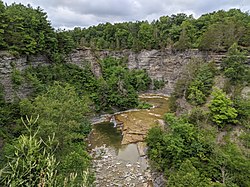
 Taughannock Creek upstream of Taughannock Falls | |
 | |
| Location | |
| Country | United States |
| State | New York |
| Region | Finger Lakes |
| Counties | Tompkins, Schuyler |
| Physical characteristics | |
| Mouth | Cayuga Lake |
• location | Trumansburg |
• coordinates | 42°32′57″N 76°35′57″W / 42.54917°N 76.59917°W |
| Basin size | 67 sq mi (170 km2)[1] |
| Basin features | |
| Waterfalls | Taughannock Falls |
Taughannock Creek is a river located in Tompkins and Schuyler counties in New York. It flows into Cayuga Lake east of Trumansburg. Taughannock Falls is located on the creek.
Course
[edit]Taughannock Falls' main cataract is a 215-foot drop (66 m),[2] making it 33 feet (10 m) taller than Niagara Falls. It is the tallest single-drop waterfall east of the Rocky Mountains.[3][4] The waterfall is located along the creek, which flows through a long gorge with cliffs up to 400 feet (120 m) high.

References
[edit]- ^ "Taughannock Creek". usgs.gov. United States Geological Survey. Retrieved May 30, 2017.
- ^ "Taughannock Falls". World Waterfall Database. Retrieved October 1, 2015.
- ^ "Taughannock Falls". National Geographic Guide to State Parks of the United States (4th ed.). Washington, D.C.: National Geographic Society. 2012. pp. 54–55. ISBN 1426208898. Retrieved October 2, 2015.
- ^ O'Brian, Mike (May 24, 2015). "The Natural Wonder of Taughannock Falls State Park". Time Warner Cable News - Southern Tier. Retrieved October 2, 2015.
