Talk:Mirza Abu Bakr Dughlat
Appearance
| This article is rated Stub-class on Wikipedia's content assessment scale. It is of interest to the following WikiProjects: | ||||||||
| ||||||||
Burrial place
[edit]
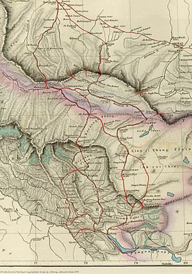
Henry Trotter's sketch map places a "Mazar Abu Bakar" where the route to Sanju Pass departs the Karakash Valley. In official survey maps however the same location is labelled "Al Nazar". (Trotter's Ai Nazar is on the route to the Kilian pass.) There are plenty of farmlands in the area now, and a village that the Chinese have named "Sarikia". -- Kautilya3 (talk) 10:00, 14 November 2022 (UTC)
- The modern Saitula township (or "town") covers this whole area. -- Kautilya3 (talk) 10:03, 14 November 2022 (UTC)
- His burial is probably in the region. However, Chinese source seems to not corroborate with Trotter or other British sources on its location:
- This tourism site mentioned "Mirza Ababaikri Kurgan site in Momoke Village" became culturally protected site in 2015. Momoke Village is in Kokyar Township 37°22′02″N 76°56′56″E / 37.367275°N 76.948913°E, which is not near Shahidulla.
- This hiking blog (warning: picture of dead donkey that slip and fell):
- mentioned Ababakar fortress (north of Sanju Pass) -- Google translate mistranslate Ababakar as "Ababak Day" ("day" is pronounced "ri" in Chinese).
- mentioned "Kriyang Langan Ruins" (Kilian Langar?), located roughly where Ali Nazar is on Trotter's map. It says that is a fort built by "Mirza Abu Kaka" an invader from Badakhshan from 1800s.
- --Voidvector (talk) 06:19, 15 November 2022 (UTC)
- His burial is probably in the region. However, Chinese source seems to not corroborate with Trotter or other British sources on its location:

