Szátok
Appearance
Szátok | |
|---|---|
 A view of Szátok. | |
| Coordinates: 47°57′17″N 19°14′04″E / 47.95464°N 19.234471°E | |
| Country | Hungary |
| Region | Northern Hungary |
| County | Nógrád |
| District | Rétság |
| Government | |
| • Mayor | Pacsa Szilvia (Ind.) |
| Area | |
• Total | 8.95 km2 (3.46 sq mi) |
| Population (2022)[3] | |
• Total | 551 |
| • Density | 62/km2 (160/sq mi) |
| Time zone | UTC+1 (CET) |
| • Summer (DST) | UTC+2 (CEST) |
| Postal code | 2656 |
| Area code | 35 |
| Website | szatok |
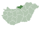
Szátok is a village and municipality in Nógrád County, Hungary.
References
[edit]- ^ "Település adatlap". Nemzeti Választási Iroda (in Hungarian). Retrieved 29 July 2024.
- ^ "Detailed Gazetteer of Hungary". www.ksh.hu. Retrieved 29 July 2024.
- ^ "Census 2022". Census 2022. Retrieved 29 July 2024.


