Sota, South Papua
Appearance
Sota | |
|---|---|
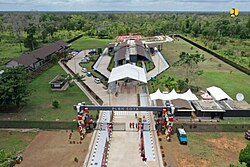
 Sota border post | |
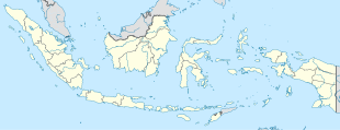
| Coordinates: 8°25′21.9288″S 140°59′53.1312″E / 8.422758000°S 140.998092000°E | |
| Country | |
| Province | South Papua |
| Regency | Merauke Regency |
| District | Sota District |
| Elevation | 72 ft (22 m) |
| Population (2010) | |
• Total | 1,300[1] |
| Time zone | UTC+9 (Indonesia Eastern Standard Time) |
Sota is a village in Sota district, Merauke Regency in South Papua province, Indonesia. Its population is 1300.[1]: 2052 Sota and Jayapura are the only places with a direct road connection from Indonesia to Papua New Guinea.
Climate
[edit]Sota has a tropical monsoon climate (Am) with moderate to little rainfall from May to November and heavy rainfall from December to April.
| Climate data for Sota | |||||||||||||
|---|---|---|---|---|---|---|---|---|---|---|---|---|---|
| Month | Jan | Feb | Mar | Apr | May | Jun | Jul | Aug | Sep | Oct | Nov | Dec | Year |
| Mean daily maximum °C (°F) | 30.9 (87.6) |
30.8 (87.4) |
30.8 (87.4) |
30.8 (87.4) |
30.2 (86.4) |
29.2 (84.6) |
28.5 (83.3) |
29.0 (84.2) |
30.3 (86.5) |
31.1 (88.0) |
32.0 (89.6) |
31.7 (89.1) |
30.4 (86.8) |
| Daily mean °C (°F) | 26.9 (80.4) |
26.9 (80.4) |
27.0 (80.6) |
26.8 (80.2) |
26.4 (79.5) |
25.5 (77.9) |
24.8 (76.6) |
24.9 (76.8) |
25.7 (78.3) |
26.5 (79.7) |
27.2 (81.0) |
27.3 (81.1) |
26.3 (79.4) |
| Mean daily minimum °C (°F) | 23.0 (73.4) |
23.0 (73.4) |
23.2 (73.8) |
22.9 (73.2) |
22.7 (72.9) |
21.8 (71.2) |
21.2 (70.2) |
20.9 (69.6) |
21.1 (70.0) |
21.9 (71.4) |
22.4 (72.3) |
22.9 (73.2) |
22.3 (72.1) |
| Average precipitation mm (inches) | 266 (10.5) |
245 (9.6) |
263 (10.4) |
184 (7.2) |
126 (5.0) |
62 (2.4) |
48 (1.9) |
33 (1.3) |
51 (2.0) |
77 (3.0) |
108 (4.3) |
243 (9.6) |
1,706 (67.2) |
| Source: Climate-Data.org[2] | |||||||||||||
References
[edit]- ^ a b "Population of Indonesia by Village: Result of 2010 Population Census" (PDF). Statistics Indonesia. Archived from the original (PDF) on 6 April 2013. Retrieved 2020-07-25.
- ^ "Climate: Sota". Climate-Data.org. Retrieved July 25, 2020.


