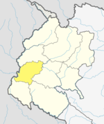
Sirsha, Nepal
Appearance
Sirsha
शीर्ष | |
|---|---|
 Sirsha Village Image from Mukesh Pandey Gallery. | |
| Coordinates: 29°10′N 80°22′E / 29.17°N 80.36°E | |
| Country | |
| Zone | Mahakali Zone |
| District | Dadeldhura District |
| Population (1991) | |
• Total | 7,878 |
| Time zone | UTC+5:45 (Nepal Time) |
Sirsha is a village development committee in Dadeldhura District in the Mahakali Zone of Sudurpaschim Province, Nepal. The 1991 Nepal census noted a population of 7878 People Living in 1269 individual households.[1]
References
[edit]- ^ "Nepal Census 2001". Nepal's Village Development Committees. Digital Himalaya. Retrieved 19 November 2008.
External links
[edit]


