Shambe National Park
Appearance
| Shambe National Park | |
|---|---|
Map of South Sudan | |
| Location | South Sudan |
| Coordinates | 6°58′48″N 30°34′48″E / 6.98000°N 30.58000°E[1] |
| Area | 620 km2 (240 sq mi) |
| Established | 1985 |
 | |
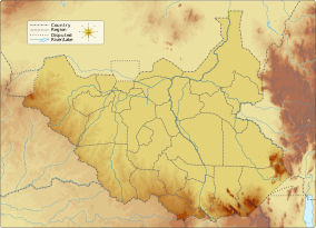
The Shambe National Park is a national park in South Sudan, located on the west bank of the White Nile.[2] It was established in 1985 and extends over an area of 620 km2 (240 sq mi).[3]
The national game park is in the remote area of Adior payam and extend southward to Kenisa in Malek payam near Ramciel South Sudan. Another name for Shambe is "Anyoop”.
It was primarily established to provide protection to certain wild animals, such as foxes, monkeys, lions, gazelles, giraffes and ostriches.[4]
References
[edit]- ^ "Shambe National Park". protectedplanet.net.
- ^ "Shambe National Park". Fortune of Africa South Sudan. 2013-08-03. Retrieved 2021-02-04.
- ^ World Database on Protected Areas[permanent dead link]
- ^ "Shambe National Park". Fortune of Africa South Sudan. 2013-08-03. Retrieved 2021-02-04.

