Seligman Airport
Appearance
Seligman Airport | |||||||||||
|---|---|---|---|---|---|---|---|---|---|---|---|
 | |||||||||||
| Summary | |||||||||||
| Airport type | Public | ||||||||||
| Owner | Yavapai County | ||||||||||
| Serves | Seligman, Arizona | ||||||||||
| Elevation AMSL | 5,237 ft / 1,596 m | ||||||||||
| Coordinates | 35°20′06″N 112°53′11″W / 35.33500°N 112.88639°W | ||||||||||
| Map | |||||||||||
 | |||||||||||
| Runways | |||||||||||
| |||||||||||
| Statistics (2016) | |||||||||||
| |||||||||||
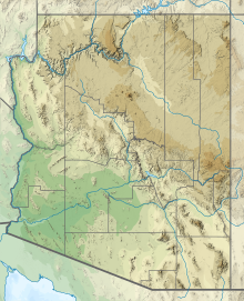
Seligman Airport (FAA LID: P23) is a public use airport located 1.15 miles (1.00 nmi; 1.85 km) northwest of the central business district of Seligman, Arizona, United States, a census designated place located in Yavapai County.[2] The airport has been owned by Yavapai County since 1985, and was leased by the county prior to then.[3]
Facilities and aircraft
[edit]
Seligman Airport covers an area of 140 acres (57 ha) at an elevation of 5,237 feet (1,596 m) above mean sea level. It has one runway designated 04/22 with an asphalt surface measuring 4,800 by 75 feet (1463 x 22 m).[4]
For the 12-month period ending April 14, 2016, the airport had 1,300 aircraft operations: 100% general aviation. In December 2017, there were two aircraft based at the airport.
See also
[edit]References
[edit]- ^ FAA Airport Form 5010 for P23 PDF. Federal Aviation Administration. effective December 7, 2017.
- ^ "Seligman Airport (FAA: P23)". SkyVector Aeronautical Charts. Retrieved December 19, 2017.
- ^ "Seligman Airport Master Plan" (PDF). Yavapai County Government. Retrieved December 19, 2017.
- ^ "Seligman Airport". Yavapai County Government. Retrieved December 19, 2017.
External links
[edit]- Resources for this airport:
- FAA airport information for P23
- AirNav airport information for P23
- FlightAware airport information and live flight tracker
- SkyVector aeronautical chart for P23


