Schwesing
Appearance
Schwesing Svesing | |
|---|---|
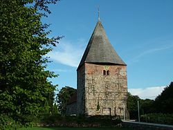
 The church in Schwesing | |
| Coordinates: 54°30′N 9°8′E / 54.500°N 9.133°E | |
| Country | Germany |
| State | Schleswig-Holstein |
| District | Nordfriesland |
| Municipal assoc. | Viöl |
| Government | |
| • Mayor | Wolfgang Sokoll |
| Area | |
• Total | 15.63 km2 (6.03 sq mi) |
| Elevation | 12 m (39 ft) |
| Population (2022-12-31)[1] | |
• Total | 955 |
| • Density | 61/km2 (160/sq mi) |
| Time zone | UTC+01:00 (CET) |
| • Summer (DST) | UTC+02:00 (CEST) |
| Postal codes | 25813 |
| Dialling codes | 04841 |
| Vehicle registration | NF |
| Website | www.amt-vioel.de |
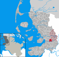
Schwesing (Danish: Svesing, North Frisian: Swiasing) is a municipality in the district of Nordfriesland, in Schleswig-Holstein, Germany.
History
[edit]
From September 25, 1944, until December 11, 1944, a concentration camp was established near Glasau.[2] It was a subcamp to the Neuengamme concentration camp.
Culture
[edit]Schwesing is one of the few places where the old, German card game of Bruus is still played. Tournaments are held regularly in the winter months and, in 2019, the 1st Bruus International Open took place.[3]
See also
[edit]Notes
[edit]- ^ "Bevölkerung der Gemeinden in Schleswig-Holstein 4. Quartal 2022" (XLS) (in German). Statistisches Amt für Hamburg und Schleswig-Holstein.
- ^ The camp is listed as No. 643 Husum-Schwesing, Kreis Husum, in the official German list Archived 2009-04-23 at the Wayback Machine (in German)
- ^ 1. Schwesinger "Bruus International Open" at schwesing.de. Retrieved 19 Dec 2020.


