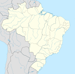
Santa Marta crater
Appearance
| Santa Marta crater | |
|---|---|
| Impact crater/structure | |
| Confidence | Confirmed |
| Diameter | 10 km (6.2 mi) |
| Age | ~66-100 Ma Late Cretaceous |
| Exposed | Yes |
| Drilled | No |
| Location | |
| Location | Parnaíba Basin |
| Coordinates | 10°10′S 45°15′W / 10.167°S 45.250°W |
| Country | Brazil |
| State | Piauí |
Santa Marta crater is a newly confirmed impact crater in Piauí State, northeastern Brazil.[1] It is 10 kilometres (6.2 mi) in diameter and it is estimated to have formed between 100 and 66 Ma, during the Late Cretaceous.
Description
[edit]Its impact origin was first proposed by S. Master and J. Heymann in 2000 based primarily on satellite remote sensing data[2] and was confirmed more than a decade later after conclusive evidence of shock metamorphism such as breccia and shatter cones were found.[3]
See also
[edit]References
[edit]- ^ "Santa Marta". Earth Impact Database. Planetary and Space Science Centre University of New Brunswick Fredericton. Retrieved 2017-10-09.
- ^ Master, S.; Heymann, J (2000). A Possible New Impact Structure near Gilbués in Piauí Province, Northeastern Brazil, Meteoritics & Planetary Science, vol. 35, Supplement, p.A105
- ^ A. P. Crósta and M. A. Vasconcelos (2013). Confirmation Of The Impact Origin Of The Santa Marta Crater, Brazil, 76th Annual Meteoritical Society Meeting


