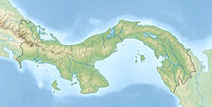
Santa María River (Panama)
Appearance
| Santa María River (Panama) | |
|---|---|
| Location | |
| Country | Panama |
| Physical characteristics | |
| Mouth | |
• coordinates | 8°05′27″N 80°29′00″W / 8.0907°N 80.4833°W |
The Santa María River (Panama) is a river of Panama.[1] The river runs approximately 148 kilometers.[2] The Santa María River's headwaters are located in the district of Santa Fe, Veraguas.[3] The mouth of the river is in the Gulf of Parita in Panama's Herrera Province.[4]
See also
[edit]References
[edit]- ^ "Rio Santa Maria". GeoNames. National Geospatial Intelligence Agency. Retrieved July 28, 2021.
- ^ Steeves, Charlotte (2016). "Water Quality in Relation to Land-use of the upper 62.8 Kilometers of the Santa Maria River, Santa Fe, Veraguas Using Benthic Macroinvertebrates as Indicators". Digital Collections. Archived from the original on 2021-08-15. Retrieved 2021-08-14.
- ^ Id. at 6.
- ^ Id. at 6.
- Rand McNally, The New International Atlas, 1993.
- CIA map, 1995.

