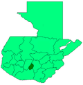
Santa Lucía Milpas Altas
Santa Lucía Milpas Altas | |
|---|---|
Municipality and town | |
| Coordinates: 14°35′00″N 90°41′00″W / 14.58333°N 90.68333°W | |
| Country | |
| Department | Sacatepéquez Department |
| Area | |
• Total | 7.4 sq mi (19.1 km2) |
| Population (2018 census)[1] | |
• Total | 15,570 |
| • Density | 2,100/sq mi (820/km2) |
| Climate | Cwb |
Santa Lucía Milpas Altas (Spanish pronunciation: [ˈsanta luˈsi.a ˈmilpas ˈaltas]) is a town and municipality in the Guatemalan department of Sacatepéquez. The town has a population of 12,234 (2018 census).[2]
History
[edit]In the 1540s, bishop Francisco Marroquín split the ecclesiastical administration of the central valley of Guatemala between the Order of Preachers and the Franciscans, assigning Sumpango's curato to the former.[3] In 1638, the Dominicans separated their large doctrines in groups revolving around six convents:
| Convent | Doctrines or curatos | Convent | Doctrines or curatos |
|---|---|---|---|
| Guatemala |
|
Amatitlán | |
| Verapaz | |||
| Sonsonate |
| ||
| San Salvador |
|
Sacapulas |
Ecclesiastic historian Domingo Juarros wrote that in 1754, by virtue of a royal order of the borbon reforms of king Carlos III all curatos and doctrines of the regular clergy were moved on to the secular clergy.[5]
Climate
[edit]Santa Lucía Milpas Altas has a subtropical highland climate (Köppen climate classification: Cwb).
| Climate data for Santa Lucía Milpas Altas | |||||||||||||
|---|---|---|---|---|---|---|---|---|---|---|---|---|---|
| Month | Jan | Feb | Mar | Apr | May | Jun | Jul | Aug | Sep | Oct | Nov | Dec | Year |
| Mean daily maximum °C (°F) | 20.6 (69.1) |
21.7 (71.1) |
23.1 (73.6) |
24.0 (75.2) |
22.9 (73.2) |
21.3 (70.3) |
21.4 (70.5) |
22.0 (71.6) |
21.3 (70.3) |
20.7 (69.3) |
20.6 (69.1) |
20.7 (69.3) |
21.7 (71.1) |
| Daily mean °C (°F) | 15.0 (59.0) |
15.7 (60.3) |
16.9 (62.4) |
18.1 (64.6) |
17.9 (64.2) |
17.3 (63.1) |
17.1 (62.8) |
17.3 (63.1) |
17.0 (62.6) |
16.5 (61.7) |
15.7 (60.3) |
15.3 (59.5) |
16.7 (62.0) |
| Mean daily minimum °C (°F) | 9.4 (48.9) |
9.8 (49.6) |
10.8 (51.4) |
12.2 (54.0) |
12.9 (55.2) |
13.3 (55.9) |
12.8 (55.0) |
12.6 (54.7) |
12.7 (54.9) |
12.3 (54.1) |
10.9 (51.6) |
9.9 (49.8) |
11.6 (52.9) |
| Average precipitation mm (inches) | 5 (0.2) |
5 (0.2) |
5 (0.2) |
37 (1.5) |
131 (5.2) |
281 (11.1) |
223 (8.8) |
187 (7.4) |
259 (10.2) |
146 (5.7) |
32 (1.3) |
9 (0.4) |
1,320 (52.2) |
| Source: Climate-Data.org[6] | |||||||||||||
Geographic location
[edit]This municipality is 9 km from Antigua Guatemala.[7]
See also
[edit]Notes and references
[edit]References
[edit]- ^ Citypopulation.de Population of departments and municipalities in Guatemala
- ^ Citypopulation.de Population of cities & towns in Guatemala
- ^ Juarros 1818, p. 336.
- ^ Belaubre 2001, p. 39.
- ^ Juarros 1818, p. 338.
- ^ "Climate: Santa Lucía Milpas Altas". Climate-Data.org. Retrieved 19 September 2015.
- ^ a b c SEGEPLAN. "Municipios de Sacatepéquez, Guatemala". Secretaría de Planificación y Programación de la Presidencia (in Spanish). Guatemala. Archived from the original on 29 June 2015. Retrieved 29 June 2015.
Bibliography
[edit]- Belaubre, Christopohe (2001). "Poder y redes sociales en Centroamérica: el caso de la Orden de los Dominicos (1757-1829)" (PDF). Mesoamérica (in Spanish). 41. Archived from the original (PDF) on 21 January 2015.
- Escalante Herrera, Marco Antonio (2007). "Breve información de Santa Lucía Milpas Alta". pbase.com (in Spanish). Guatemala. Archived from the original on June 20, 2010. Retrieved 20 June 2010.
- Juarros, Domingo (1818). Compendio de la historia de la Ciudad de Guatemala (in Spanish). Guatemala: Ignacio Beteta.


