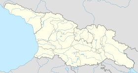
Sadakhlo
41°14′20″N 44°47′16″E / 41.23889°N 44.78778°E
Sadakhlo
სადახლო | |
|---|---|
 | |
| Coordinates: 41°14′20″N 44°47′16″E / 41.23889°N 44.78778°E | |
| Country | |
| Mkhare | Kvemo Kartli |
| Municipality | Marneuli |
| Elevation | 430 m (1,410 ft) |
| Population (2014)[1] | |
• Total | 7,337 |
| Climate | Cfa |
Sadakhlo (Georgian: სადახლო, Azerbaijani: Sadaxlı) is a village in Georgia located in the southern part of country in the administrative territory of Marneuli Municipality (Kvemo Kartli Region) at the border with Armenia. The village is about 27 kilometres (17 mi) south of the municipal center Marneuli and 50 kilometres (31 mi) south of the capital Tbilisi. It is situated along the left bank of the Debeda river. Sadakhlo is the largest village in Georgia, and is the center of the eponymous administrative community (თემი, temi) that includes 4 other nearby villages: Burma, Tazakendi, Molaoghli, and Khuldara.[2]
The Sadakhlo market played a remarkable role in the interaction between Azerbaijanis and Armenians, in light of the Nagorno-Karabakh conflict. Sadakhlo is almost entirely populated with Azerbaijanis, and is an important border town with Armenia. Since Georgia took a neutral stance in this conflict, it became a neutral territory in which both peoples could freely and safely interact with each other.[3]
Six kilometers west of Sadakhlo, in the village of Tsopi along the national route Sh37 to Akhkerpi, the ruins of the medieval Tsopi fortress are located there. This castle dates from the 5th-6th century.[4]
Population
[edit]The population of Sadakhlo village is 7,337 according to the 2014 census.[1] Apart from a few dozen people, the village is mono-ethnic Azerbaijani (99.8%).
| Year | 1897 | 1923 | 1939 | 1959 | 1970 | 1979 | 1989 | 2002[5] | 2014 | |||||
|---|---|---|---|---|---|---|---|---|---|---|---|---|---|---|
| Number | - | 1,839 | - | - | - | |||||||||
| Data: 1923[6] 1970,[7] 1979,[8] Census 2002 and 2014[1] Note:[5] | ||||||||||||||
Transport
[edit]
The road of international importance S7 (E001), the main road between Tbilisi and Yerevan (Armenia), passes through Sadakhlo. The Sadakhlo - Bagratashen border crossing is the most important of the four vehicular crossings between Georgia and Armenia. More than 1.2 million incoming travellers were registered in 2019.[10] This is 15.7% of all inbound travellers to Georgia. This also leads to additional investments in infrastructure. With European money the car bridge across the Debeda is being renovated and expanded to four lanes.[11]
There is a train station in Sadakhlo, which is on the Tbilisi - Gyumri - Yerevan railway line which opened in 1899. The railway runs along the village and crosses the border parallel to the S7. There are frequent night trains between Tbilisi and Yerevan. The station serves not only as a terminus for the Tbilisi - Sadakhlo commuter trains and stop for the international trains, but also as a border post for the latter. Nearly 3,400 passengers entered Georgia here in 2019.[10]
From the center of Sadakhlo, the national route Sh37 heads west to Akhkerpi, which also has a border crossing to Armenia. It is Georgia's least used border crossing with 133 arriving travelers in 2019.[10]
See also
[edit]References
[edit]- ^ a b c "All places: 2002, 2014 censuses". Population Statistics Eastern Europe and former USSR. Retrieved 2022-03-24.
- ^ "Main Results of the 2014 Census (Publication)" (PDF). Census.ge, National Statistics Office of Georgia (Geostat) (in Georgian). 2016-04-28. p. 343. Retrieved 2022-03-24.
- ^ "Sadakhlo Neutral Zone for Armenian-Azerbaijani Contacts: Use of Trade as a Tool for Conflict Transformation". Journal of Conflict Transformation - Caucasus Edition. 2011-04-01. Retrieved 2022-03-24.
- ^ "About Tsopi Fortress". Georgian Travel Guide. Retrieved 2022-03-24.
- ^ a b The 2014 census found an inexplicable gap with the data from the national statistical office Geostat. UN-assisted research has found the 2002 census was inflated by about 8-9 percent. See,[9] "1. Introduction", Page 1.
- ^ "Ethnic composition rural Georgia 1923". Population Statistics Eastern Europe and former USSR. Retrieved 2022-01-18.
- ^ "Ethnic composition of Georgia 1970". Population Statistics Eastern Europe and former USSR. Retrieved 2022-01-18.
- ^ "Ethnic composition of Georgia 1979". Population Statistics Eastern Europe and former USSR. Retrieved 2022-01-18.
- ^ "Population Dynamics in Georgia - An Overview Based on the 2014 General Population Census Data" (PDF). National Statistics Office of Georgia, Geostat. 2017-11-29. Retrieved 2022-03-06.
- ^ a b c "Georgian Tourism in Figures 2019" (PDF). Georgian National Tourism Administration. 2021-12-01. Retrieved 2022-03-24.
- ^ "New Bridge on Debeda River in the Territory of Sadakhlo-Bagratasheni Checkpoint". Georoad. 2021-07-09. Retrieved 2022-03-24.


