Rahbat
Appearance
This article needs additional citations for verification. (February 2024) |
Rahbat | |
|---|---|
 | |
| Country | Algeria |
| Province | Batna |
| Time zone | UTC+1 (West Africa Time) |
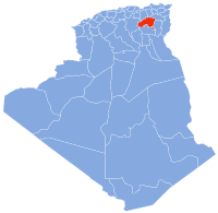
Rahbat is a town in the Batna Province of north-eastern Algeria.[1]
References
[edit]- ^ "Répartition de la population résidente des ménages ordinaires et collectifs, selon la commune de résidence et la dispersion" (PDF). ons.dz (in French). Retrieved 11 February 2024.

