
Prairie Point, Texas
Prairie Point, Texas | |
|---|---|
 Prairie Point  Prairie Point | |
| Coordinates: 33°29′43″N 97°28′28″W / 33.49528°N 97.47444°W | |
| Country | United States |
| State | Texas |
| County | Cooke |
| Elevation | 879 ft (268 m) |
| Time zone | UTC-6 (Central (CST)) |
| • Summer (DST) | UTC-5 (CDT) |
| Area code | 940 |
| GNIS feature ID | 1382568[1] |
Prairie Point is an unincorporated community in Cooke County, Texas, United States.[1] According to the Handbook of Texas, the community had a population of 22 in 2009. It is located within the Dallas-Fort Worth Metroplex.
History
[edit]Prairie Point had a factory, a business, and some scattered homes in 1936. From the 1930s to the 1960s, the population was approximately 25, which increased to an estimated 30 in 1968. In 2009, it was 22.[2]
Geography
[edit]Prairie Point is located on Farm to Market Road 922, 20 mi (32 km) southwest of Gainesville near the Montague County line in southwestern Cooke County.[2]
Education
[edit]Today, Prairie Point is served by the Era Independent School District.
References
[edit]Municipalities and communities of Cooke County, Texas, United States | ||
|---|---|---|
| Cities | 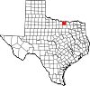 | |
| Towns | ||
| CDPs | ||
| Other communities | ||
| Ghost towns | ||