Portal:California/Selected panorama/Archives
If you wish to add a panoramic image for rotation within this portal, please
- Add the image in to a subpage of this portal, such as Portal:California/Selected picture/#, replacing the "#" with the number above the current highest. For example, if 20 pictures are in roation, you would make the number of the picture you are creating 21.
- Update the panoramic picture maximum limit paramater on the main Portal
- Fair use images which are not released under a free-license (i.e. Public Domain, GNU Free Documentation License) will be removed on sight.
- Update this list accordingly
Panoramic images in rotation
[edit]Lake Berryessa is the largest lake in Napa County, California. This reservoir is formed by the Monticello Dam, which provides water and hydroelectricity to the North Bay region of the San Francisco Bay Area. Prior to its inundation, the Beryessa Valley was an agricultural region, whose soils were considered among the finest in the country.
Industry (or City of Industry) is a city in the San Gabriel Valley section of Los Angeles County, California, United States. It was incorporated June 18, 1957. The population was 777 at the 2000 census. The city was incorporated to prevent surrounding cities from annexing industrial land for tax revenue.
State Route 166 is a part of the California Freeway and Expressway System and is eligible for the State Scenic Highway System. It starts off in Guadalupe in northwestern Santa Barbara County and heads east towards the largest city on its eastern journey: Santa Maria.
The Crystal Range is a small group of mountains located within the Desolation Wilderness in the U.S. state of California. It is a subrange of the Sierra Nevada. The highest and most southerly peak is Pyramid Peak at 9987 ft; Mount Agassiz is next north at 9967 ft, with Mount Price (9975 ft) rounding out the southern group of peaks. Tells Peak is the northernmost named peak in the range.
Benicia Capitol State Historic Park is a state park in Benicia, California. The park is dedicated to California’s third capitol building, where the California State Legislature and bureaucracy convened from February 3, 1853 to February 24, 1854. It is the only pre-Sacramento capitol that survives.
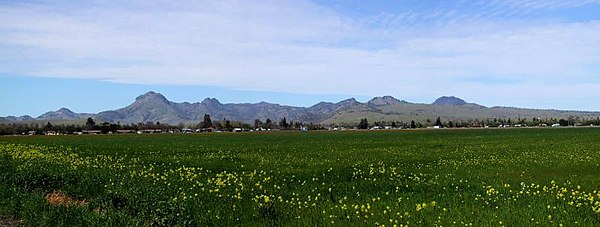
The Sutter Buttes, also known as the Marysville Buttes or Histum Yani (Maidu), are a small circular complex of eroded volcanic lava domes which rise above the flat plains of the California Central Valley, United States. The highest peak, South Butte, reaches about 2,130 feet (650 m) above sea level. The Buttes are located just outside of Yuba City, California in the Sacramento Valley, the northern part of Central Valley.
The City and County of San Francisco is the fourth most populous city in California and the 14th most populous city in the United States, with a 2007 estimated population of 764,976. One of the most densely populated major American cities, San Francisco is part of the much larger San Francisco Bay Area, which is home to approximately 7.2 million people.
The Sierra Nevada (Spanish for "Snowy Range") is a mountain range located in the U.S. state of California. In a few places, it overlaps into neighboring Nevada. The range is also known informally as the Sierra, the High Sierra, and the Sierras.
Lake Irvine (known in Orange County as Irvine Lake) is a reservoir in Orange County, California. The lake is located northeast of the city of Irvine close to Irvine Regional Park. The lake is formed by the Santiago Dam at its north end, which was built between 1929 and 1931, and the lake was originally called the Santiago Reservoir.
The Kern River is a river in the U.S. state of California, approximately 164 miles (264 km) long. It drains an area of the southern Sierra Nevada mountains northeast of Bakersfield. Fed by snowmelt near Mount Whitney, the river passes through scenic canyons in the mountains and is a popular destination for whitewater rafting and kayaking.
Skyline Boulevard stretches through the Santa Cruz Mountains, here near Palo Alto, California.
Los Angeles, California is the second-largest city in the United States, with an estimated population of 3.85 million people. Los Angeles is one of the cultural, economic, scientific and entertainment centers of the country.


