Onuimo
Appearance
Onuimo | |
|---|---|
 onuimo Local Government | |
 | |
| Country | |
| State | Imo State |
| Area | |
• Total | 34 sq mi (87 km2) |
| Population (2006) | |
• Total | 99,368 |
| • Density | 3,471/sq mi (1,340.3/km2) |
| Time zone | UTC+1 (WAT) |
 | |
Onuimo is a Local Government Area of Imo State, Nigeria.[1] Its headquarters are in the town of Okwe. It comprises four towns namely: Okwe, Okwelle, Umuduru-Egbeaguru and Umuna.
It has an area of 87 km2 and a population of 99,247 at the 2006 census. The postal code of the area is 470.[2]
Climate
[edit]Onuimo in Imo has a tropical wet and dry or savanna climate and is located at an elevation of 123.97 metres (406.73 feet) above sea level (Classification: Aw). The city's average annual temperature is -0.58% lower than Nigeria's averages at 28.88°C (83.98°F). Imo generally experiences 268.89 wet days (73.67% of the time) annually, with precipitation totaling roughly 234.25 millimetres (9.22 inches). [2]
Gallery
[edit]-
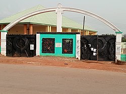
Umucheke market center in Onuimo
-
Umucheke Health Center in Onuimo
References
[edit]- ^ "Imo (State):Onuimo Local Government". www.citypopulation.de. Retrieved May 22, 2016.
- ^ a b "Post Offices- with map of LGA". NIPOST. Archived from the original on 2012-11-26. Retrieved 2009-10-20.


