Olševa
Appearance
| Olševa | |
|---|---|
 Olševa | |
| Highest point | |
| Elevation | 1,929 m (6,329 ft) |
| Prominence | 590 m (1,940 ft)[1] |
| Coordinates | 46°26′59.280″N 14°41′22.920″E / 46.44980000°N 14.68970000°E |
| Geography | |
| Location | Slovenia |
| Parent range | Karawanks |
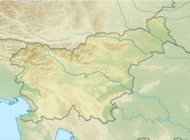
Mount Olševa (pronounced [ˈoːu̯ʃɛʋa]; German Olschewa) is a ridge mountain in the eastern part of the Karawanks near the border with Austria. The mountain separates Carinthia from Styria. Its highest point, Govca, is 1,929 meters (6,329 ft) high. Other peaks along the 5-kilometer (3.1 mi) ridge are Obel kamen on the western side, and Smooth Peak (Gladki vrh) and Pretty Peak (Lepi vrh) on the eastern part. About 200 meters (660 ft) below Obel kamen lies Potok Cave (Slovene: Potočka zijalka), an archaeological site from the Stone Age. To the southwest of the mountain, at an altitude of 1,115 m (3,658 ft), there is a chalybeate (iron-rich) spring.[2][3]
Routes
[edit]- 2¼ hrs from Podolševa (difficult marked route)
- 3 hrs from the lower ridge (Spodnje sleme; easy marked route)
- 3¾ hrs from the Firšt Inn (Gostišče Firšt; somewhat demanding marked route)
- 1¾ hrs from Upper Meadow (Zadnji travnik; easy marked route)
References
[edit]- ^ "Govca - peakbagger.com". peakbagger.com. Retrieved 17 February 2015.
- ^ Hieng, Primož (4 March 2022). "V teh 5 slovenskih krajih izvira zdravilna železna voda" [In These Five Slovenian Towns, the Healing Iron Water Springs]. Onaplus (in Slovenian).
- ^ "Geopedia.si" (Map). layer: settlements. Geodetic Institute of Slovenia. Sinergise, d.o.o. Retrieved 6 June 2023.
- Slovenska planinska pot, Planinski vodnik, PZS, 2012, Milenko Arnejšek - Prle, Andraž Poljanec ISBN 978-961-6870-04-7
External links
[edit] Media related to Olševa at Wikimedia Commons
- Route, Description, & Photos
- Stalna razstava Potočka zijalka (Potok Cave Permanent Display) (slo)


