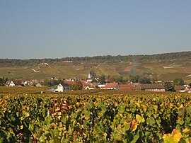
Oger, Marne
Appearance
Oger | |
|---|---|
Part of Blancs-Coteaux | |
 | |
| Coordinates: 48°57′30″N 4°00′47″E / 48.9583°N 4.0131°E | |
| Country | France |
| Region | Grand Est |
| Department | Marne |
| Arrondissement | Épernay |
| Canton | Vertus-Plaine Champenoise |
| Commune | Blancs-Coteaux |
Area 1 | 15.06 km2 (5.81 sq mi) |
| Population (2019)[1] | 506 |
| • Density | 34/km2 (87/sq mi) |
| Time zone | UTC+01:00 (CET) |
| • Summer (DST) | UTC+02:00 (CEST) |
| Postal code | 51190 |
| Elevation | 115 m (377 ft) |
| 1 French Land Register data, which excludes lakes, ponds, glaciers > 1 km2 (0.386 sq mi or 247 acres) and river estuaries. | |
Oger (French pronunciation: [ɔʒe]) is a former commune in the Marne department in north-eastern France. On 1 January 2018, it was merged into the new commune of Blancs-Coteaux.[2]
Champagne
[edit]The village's vineyards are located in the Côte de Blancs subregion of Champagne, and are classified as Grand Cru (100%) in the Champagne vineyard classification.
See also
[edit]References
[edit]- ^ Téléchargement du fichier d'ensemble des populations légales en 2019, INSEE
- ^ Arrêté préfectoral 21 December 2017 (in French)
Wikimedia Commons has media related to Oger.


