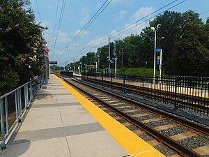
Nursery Road station
Appearance
Nursery Road | |||||||||||
|---|---|---|---|---|---|---|---|---|---|---|---|
| Baltimore Light Rail station | |||||||||||
 The Nursery Road station in August 2018 | |||||||||||
| General information | |||||||||||
| Location | 6825 Baltimore-Annapolis Boulevard Pumphrey, Maryland | ||||||||||
| Coordinates | 39°13′18″N 76°38′29″W / 39.22175°N 76.64129°W | ||||||||||
| Owned by | Maryland Transit Administration | ||||||||||
| Platforms | 2 side platforms | ||||||||||
| Tracks | 2 | ||||||||||
| Connections | |||||||||||
| Construction | |||||||||||
| Parking | 37 free spaces | ||||||||||
| Accessible | Yes | ||||||||||
| History | |||||||||||
| Opened | 1993 | ||||||||||
| Passengers | |||||||||||
| 2017 | 427 daily[1] | ||||||||||
| Services | |||||||||||
| |||||||||||
| |||||||||||
Nursery Road station is a Baltimore Light Rail station in Pumphrey, Maryland. There are 37 free parking spaces and connections can be made to MTA Maryland's Route 17 bus from here.[2]
Though officially located at 6825 Baltimore-Annapolis Boulevard (MD 648) the actual location of the Nursery Road stop is at the corner of Nursery Road and South Old Annapolis Road. Nursery Road is designated Maryland Route 168 west of Baltimore & Annapolis Boulevard, and a local street east of Route 648.
Station layout
[edit]| G | |
| Side platform, doors will open on the right | |
| Southbound | ← Light Rail toward BWI Airport or Glen Burnie (North Linthicum) |
| Northbound | Light Rail toward Fairgrounds or Hunt Valley (Baltimore Highlands) → |
| Side platform, doors will open on the right | |
| Street level | Exit/entrance |
See also
[edit]- Washington, Baltimore and Annapolis Electric Railway (1908–1935) - Pumphrey Station
- Baltimore and Annapolis Railroad (1887–1980) - Pumphrey Station
References
[edit]- ^ "Light Rail Link Cornerstone Plan" (PDF). Maryland Department of Transportation. 2018. Archived (PDF) from the original on 2023-10-03.
- ^ "Station list". Archived from the original on 2008-06-13.
External links
[edit]

