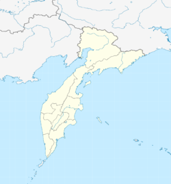
Nikolayevka, Kamchatka Krai
Nikolayevka
Николаевка | |
|---|---|
| Coordinates: 53°02′43″N 158°20′10″E / 53.04528°N 158.33611°E | |
| Country | Russia |
| Federal subject | Kamchatka Krai |
| Administrative district | Yelovsky District |
| Population | |
• Estimate (2020) | 1,815[1] |
| Postal code(s)[2] | 684032 |
Nikolayevka (also romanized as Nikolaevka) is a village (selo) in the Yelizovsky District of Kamchatka Krai, Russia. It is the administrative center of the Nikolayevskoye Rural Settlement.[3]
Geography
[edit]Nikolayevka is approximately 17 kilometres (11 mi) southwest of the city of Yelizovo, the Yelizovsky District's administrative center.[4] The village is also located several kilometers west of Avacha Bay.
Nikolayevka has historically been placed in the subarctic climate zone (Dfc) of the Köppen climate classification system, though analysis of 1991-2020 climate data has suggested the village now sits in the warm-summer humid continental climate zone (Dfb).[5][6]
History
[edit]Nikolayevka was founded in 1853 on the Paratunka River by peasants migrating eastward, and it was named in honor of Tsar Nicholas I.[citation needed] A leper colony was once located in the village.[citation needed]
On 31 August 2024, a Mil Mi-8 helicopter bound for Nikolayevka's local private airport crashed about 20 kilometres (12 mi) north of the village, killing all 22 occupants.[7][8] At the time, the helicopter was being used in a tour of the nearby Vachkazhets volcano.[9] On-board passengers included Arseny Zamyatin, the Russian Football Union's chief financial officer.[9]
Demographics
[edit]| Population | |||||||
|---|---|---|---|---|---|---|---|
| Year | 2002[10] | 2012[11] | 2013[12] | 2015[13] | 2016[14] | 2018[15] | 2020[1] |
| Pop. | 1,839 | 1,829 | 1,829 | 1,829 | 1,833 | 1,818 | 1,815 |
| ±% | — | −0.5% | +0.0% | +0.0% | +0.2% | −0.8% | −0.2% |
References
[edit]- ^ a b "Справочник по административно-территориальному устройству Камчатского края, 2020". Government of Kamchatka Krai. Retrieved 7 September 2024.
- ^ Почта России. Информационно-вычислительный центр ОАСУ РПО. (Russian Post). Поиск объектов почтовой связи (Postal Objects Search) (in Russian)
- ^ "Nikolaevskoe". Kamgov. Government of Kamchatka Krai. Retrieved 7 September 2024.
- ^ "Nikolayevka distance to Yelizovo" (Map). Google Maps. Retrieved 7 September 2024.
- ^ "Koppen Earth". Koppen Earth. Haizea Analytics. Retrieved 7 September 2024.
- ^ Beck, Hylke E.; McVicar, Tim R.; Vergopolan, Noemi; Berg, Alexis; Lutsko, Nicholas J.; Dufour, Ambroise; Zeng, Zhenzhong; Jiang, Xin; van Dijk, Albert I. J. M.; Miralles, Diego G. (23 October 2023). "High-resolution (1 km) Köppen-Geiger maps for 1901–2099 based on constrained CMIP6 projections". Scientific Data. 10 (1). doi:10.1038/s41597-023-02549-6. PMC 10593765. Retrieved 8 September 2024.
- ^ Kostereva Milena (1 September 2024). "При крушении Ми-8 на Камчатке погибли 3 члена экипажа и 19 туристов" [Mi-8 Crash in Kamchatka Kills 3 Crew Members and 19 Tourists]. Kommersant (in Russian). Archived from the original on 1 September 2024. Retrieved 1 September 2024.
- ^ "17 Bodies Found After Helicopter Crashes in Far East Russia's Kamchatka". The Moscow Times. Archived from the original on 1 September 2024. Retrieved 1 September 2024.
- ^ a b Rubnikovich, Oleg (1 September 2024). "Туристы разбились о склон" [Tourists Crashed Into Slope]. Kommersant (in Russian). Archived from the original on 6 September 2024. Retrieved 2 September 2024.
- ^ "Данные Всероссийской переписи населения 2002 года: таблица № 02c. Численность населения и преобладающая национальность по каждому сельскому населённому пункту". Rosstat. Retrieved 7 September 2024.
- ^ "Справочник по административно-территориальному устройству Камчатского края, 2012". Government of Kamchatka Krai. Retrieved 7 September 2024.
- ^ "Справочник по административно-территориальному устройству Камчатского края, 2013". Government of Kamchatka Krai. Retrieved 7 September 2024.
- ^ "Справочник по административно-территориальному устройству Камчатского края, 2015". Government of Kamchatka Krai. Retrieved 7 September 2024.
- ^ "Справочник по административно-территориальному устройству Камчатского края, 2016". Government of Kamchatka Krai. Retrieved 7 September 2024.
- ^ "Справочник по административно-территориальному устройству Камчатского края, 2018". Government of Kamchatka Krai. Retrieved 7 September 2024.


