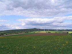
Naxburg
Appearance
You can help expand this article with text translated from the corresponding article in German. (July 2010) Click [show] for important translation instructions.
|
| Naxburg | |
|---|---|
 | |
| Highest point | |
| Elevation | 554 m (1,818 ft) |
| Geography | |
 | |
| Location | Hesse, Germany |

Naxburg is a hill of Hesse, Germany.
50°27′N 9°24′E / 50.450°N 9.400°E
